
LTR: Manhattan Parks 20 Miler
By Papa Bear (a.k.a. Richard G)

This is a long training run of 20+ miles I've done with friends. Actually we've done it a few times, and sometimes we've done just the northbound portion and sometimes the southbound portion. The photos are from several different runs, so some will be sunny, some will be rainy. It's all good!
I hope to contribute a report of this sort to this blog every month or so. They all follow the theme “Beyond Central Park” and are aimed at the runner who is tired of going round and round the park when you need those long runs in preparation for a marathon. I love the park, but I also love to get out of it when I can. Usually all you need is a Metrocard and a spirit of adventure.
|
Although I put this report together in June 2012, I first did this route with my friend Melissa in late March, the first long run of spring, and it was beautiful. The flowering Trees were just gorgeous and the running route was spectacular. The route is actually a combination of two runs I had done previously, but to connect them together I made a few changes (such as starting at the Boat House in Central Park instead of Carl Schurz Park, and staying in Manhattan instead of going up to the Bronx). Those two runs are great runs in and of themselves, so consider doing them sometime. I've also kept the directions a bit sparse, but I think they are sufficient to keep you from getting lost. They were reported originally in the Newsletter and are now on my web site and they might be worth a read if you are so inclined. (Carl Schurz Park to Wave Hill / The West Side Run).
Here is a Google Map of this run you can check (Full Size Map.). It can be useful or even essential if the directions are unclear, especially when running from one park to the next. You can leave it in another browser window and jump back to it if you need to.
I call this run the "Manhattan Parks 20 Miler" because it goes up to the northernmost point in Manhattan and back, almost exclusively in parks. It's true you could go over to Riverside Park and run up to the top of Manhattan and then turn around and come back (that's in fact, what "The West Side Run" does), but I like to cover more territory and hit every park just once. If you count all the parks both coming and going (not counting Riverbank State Park, which you go under), I think you get 11. That counts the little stretch along the Hudson at 125th Street as a park, since the sign says "West Harlem Piers Park". And guess what — I ran on one of those piers. And the real point is to minimize the distance run on city streets. In this run, the longest you run on the streets is getting from Riverside Park back to Central Park on 72nd Street. All other connections are just a few blocks. And to run over 20 miles in Manhattan through 11 parks (and not repeat any part of the route) — that's pretty darn good.
The running was made much more enjoyable than say, loops in the park, since almost all of the parks were nearly empty (except for bike riders along the Hudson portion), and the trees had that in-between look where the green buds were out, but few leaves, so you could still see the "backbone" of the terrain. And on the way up that meant steep drop offs and rocky outcrops. The site of St. John's Cathedral above Morningside Park or City College above St. Nicholas Park or High Bridge Tower above High Bridge Park or the Cloisters above Fort Tryon Park or the George Washington Bridge over the Hudson River — all of them, the next after the next after the next — made the juxtaposition of the natural beauty with the man-made beauty startling. Only in New York!
As I mentioned, the run was the first long run of spring, which began the Tuesday before. And the city was really getting into spring. Callery Pears in bloom lined the streets as I walked to the park from the subway. Central Park's trees finally have green buds — if not real leaves — on all the branches. The Cherry Trees were making a good start (although I'd give them another week) and the Magnolia trees were literally exploding! The parks further north were not quite as far along, but they have definitely made progress in the last week. And the weather, which was forecast to be chilly and rainy, was quite nice: temperatures in the 50°s and partly sunny. Just about a perfect day to be out there.
Details
This blog should be considered a “teaser” since space limitations prevent us from including many of the details of the run from park to park to park. A full accounting of these details together with embedded maps and slide shows is included on my web site. Please visit this web page for the full report: Papa Bear's Manhattan Parks 20 Miler
Manhattan Parks Northbound: Central Park to Inwood Hill Park
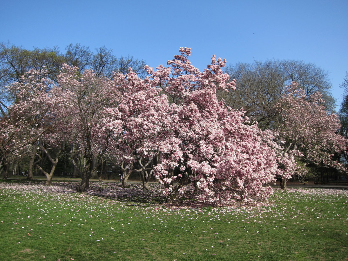 |
Central Park Magnolia Tree
|
A glance at a Manhattan map, such as the one linked above, reveals a remarkable fact: many of the parks line up with each other and follow the street grid along the length of Manhattan in an almost straight line. This is not accidental — it's the geography (or the topography, to be more precise). Manhattan is built on a series of long, high rocky ridges and outcrops (called escarpments) which have survived the overlay of the street grid. In many cases the terrain was simple too steep and rocky for laying out streets and those areas became parks. In particular, Morningside, St. Nicholas, Jackie Robinson and High Bridge Parks are all built along the same escarpment, or ridge line, and the gaps between them are generally only a few blocks long. Gorman Park lies on the other side of the same ridge and Fort Tryon and Inwood Hill Parks lie to the west on another ridge line which extends into The Bronx where it provides the "backbone" of Riverdale. We ran through these "Escarpment Parks" on the northbound section of this run.
The turnaround point was at the very northern tip of Manhattan, underneath the Henry Hudson Bridge in Inwood Hill Park overlooking the Harlem River Ship Canal, with the Spuyten Duyvil section of the Bronx visible across the water.
Manhattan Parks Southbound: The Hudson River Parks
- Papa Bear (Richard G)
The turnaround point was at the very northern tip of Manhattan, underneath the Henry Hudson Bridge in Inwood Hill Park overlooking the Harlem River Ship Canal, with the Spuyten Duyvil section of the Bronx visible across the water.
Manhattan Parks Southbound: The Hudson River Parks
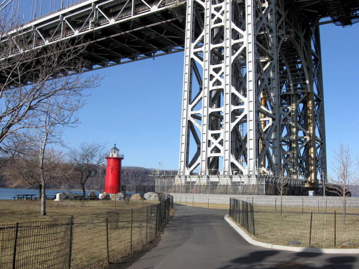
The Little Red Light House and the Great Gray Bridge
The return run was pretty much entirely along the Hudson River, or close to it. The route traverses Inwood Hill Park (from the tip of Manhattan to Dyckman Street), Fort Washington Park, Riverside Park and back to Central Park. But let's not forget Riverbank State Park (which we ran under) and West Harlem Piers Park, a recent creation.
A note on Fort Washington Park and Riverside Park: I used to think of the entire strip of park along the Hudson from 72nd Street to Dyckman Street as "Riverside Park". In fact, the park, together with Riverside Drive, was originally laid out by none other than Frederick Law Olmstead. The drive was eventually extended to Dyckman Street (north of 181st Street it was taken for the northbound lanes of the Henry Hudson Parkway in the 1930s). Remnants of the old boulevard remain in the promenade and the pavilion (named "Inspiration Point Shelter") at around 190th Street. This far northern part of Riverside Drive still exists as a short segment of road from the Dyckman Street exit of the HH Parkway east to the intersection of Dyckman Street and Broadway. But as for the park, officially, the strip of the park north of 158th Street is called Fort Washington Park. So although 125th Street or the GWB might seem logical places to separate the two parks, it is 158th Street which goes completely unnoticed when you traverse this boundary.
Putting it All Together
My legs and my running had felt good all the way up. But on the way back I started to feel first a tiredness and then some soreness in my legs. And on the long stretch of Riverside Park where there is little or no shade, I started to feel the affects of the sun. Fortunately, the tempratures stayed in the 50°s, so this did not get bothersome. But it brought back some unpleasant memories of a few of last summer's death marches along this same stretch. Remind me never to train for a marathon in the summer in New York City again! But enough of what hurt or what was sore.
When I finally got back to Central Park, I wasn't sure of the mileage, so I did the lower loop of the park rather that cutting straight across the 72nd Street transverse. It turns out I didn't need to do this since I ended up with over 21 miles. But it was good to know that I felt just as strong that last extra mile as those leading up to it — subject, of course, to the aforementioned aches and pains. When I finally got back to the Boat House I had a nice sit down, drained my hydration pack and then made my way over to 79th & Madison for some French Toast at the Nectar Café. Having lunch solo is no more fun than running solo, but my body appreciated the replenishment.
The return trip down along the Hudson was curiously just the same as the northbound section, namely 10.7 miles. That makes he final mileage (including the lower loop) 21.4 miles. If you decide to just run across the transverse to the Boat House (wimp! :) it would be 20.4 miles, just about a mile less.
Full Report with Details
And to repeat a note (above), a full accounting of the details of this run together with embedded maps and slide shows is on my web site. Please visit this web page for the full report: Papa Bear's Manhattan Parks 20 Miler
If you are hoping to do this run , but are not sure of anything, feel free to email me at papabear.newyork@gmail.com
And please check out my web site which has lots of other runs plus race reports and assorted odds and ends: Papa Bear's Beyond Central Park
|
- Papa Bear (Richard G)


0 comments:
Post a Comment