Showing posts with label Long Training Run Routes. Show all posts

Monday, November 19, 2018

Oktoberfest Run

 The Oktoberfest Run and Festivities
by Papa Bear


Papa Bear
The Germans have a way to mark the coming of the colder weather in mid September, and that is to stay inside and drink beer! It's called "Oktoberfest" and it sounds good to me. 

The best place by far we have found to celebrate Oktoberfest is in that Beer Brewing Borough of Brooklyn, and the best place by far in Brooklyn is Radegast Hall & Biergarten (Check it out) in Williamsburg. And the best way by far to get there is to run. So what are we waiting for? 

In Bavaria, where it all started, they would start in mid September and keep going till the first week of October, so that's what they do at Radegast Hall. 

The Group in Central Park 
Ready to Go
On the first full day of autumn, a group of seven runners from the NY Flyers (Ed, Heidi, Rob, Andrea, Brad, Lora, and Papa Bear) gathered in Central Park and ran some eight miles to said Radegast Hall via the Ed Koch Queensboro Bridge, the Long Island City riverfront parks, the Pulaski Bridge, through Greenpoint and lastly through Williamsburg. And when we finally got to Radegast Hall we met with a few others who had planned to meet us there, and we were all hungry and thirsty. 

Now for a few details: When we met up in Central Park, we divided our party into a faster group and slower group (which I was in) and each group would be more-or-less on their own. Initially Brad and Lora were the faster group and the rest of us, the slower. We also agreed to approach the Ed Koch Queensboro Bridge along First Avenue rather than along York Avenue to avoid the pretty steep hill on York just before the bridge. Here's our route: MapMyRun: Central Park to Radegast Hall (Note the MapMyRun software would not let me show the route within the newly opened section of Hunter's Point South Park), and off we went. 

Manhattan View from the 
LIC River front Park
When  we got to the bridge we spread out quite a bit so we (the slower group) regrouped at the Queens side. There we met Kristel who lives in Greenpoint. Off we went again with Kristel and Andrea moving ahead to become a medium speed group of 2, leaving Ed, Heidi, Rob and myself as slowpokes. That's why all the photos taken in Long Island City were of Ed, Heidi and Rob with myself as photographer.

We moved along though the stunning riverfront parks in Long Island City, first Gantry State Park and then the recently opened southern section, Hunters Point South Park. If you ever find yourself running in this section of Queens, you must take the river route (unless you happen to be running the NYC Marathon). 
At the Newly Opened South Point Park
At the south end of Hunters Point South Park, we got onto 54th and then 53rd Ave to run to the Pulaski Bridge, which we crossed and got onto Franklin Street. Now we were in Brooklyn and here the photos ended until we got to our destination. 

The four of us stayed mostly together on our trek through Greenpoint, but a bit before we got to Williamsburg, Heidi and I stayed behind since I was nursing a sore foot. We soon lost sight of Ed and Rob, but through some mystery, when we got to Radegast Hall, not only had Ed and Rob not yet arrived, but neither had the speedy Brad. 

Around the Table at Radegast Hall
At Radegast Hall: When Heidi and I arrived we met Rebecca, Stephanie (with her two toddlers Keira and Quinn) and Luiza who had planned to meet us at the Biergarten, plus Lora, Kristel and Andrea (joined by her husband Chad) from the faster groups. Finally Ed and Brad (who, it turned out, had done some extra miles) showed up and Ed told us that Rob had to skip the festivities, so now we were all accounted for and nicely filled a table (see photo, above). 

I had planned for us to arrive by 11:30, which, for the most part we did. This was a perfect time for families and folks who didn't plan to drink all afternoon. But the down side was we missed the really wild and wonderful time when the oom-pah brass band is playing and the beer is flowing and it's standing room only. 

There's a nice album of photos of the run and the festivities and I strongly advise you to check it out on the NY Flyers web site: Oktoberfest Run and Festivities Album. 

Ed and I were the last to leave at about 1:30 and to top off a fun day, I took the NYC Ferry home which leaves Williamsburg from North 5th Street.
One of the Gantries as Seen 
from the Ferry
The Ferry is fun and it's cheap and it affords you with yet another close up view of Manhattan's East River shoreline. 

So we'll see you next year when the L train will not be running and we'll all take the Ferry home. 

Gotta run! 


This post was adapted from the report on 
Papa Bear's web page


Read more...

Thursday, November 30, 2017

Runs to Beautiful Places: Fort Tryon Park and The Cloisters

Fort Tryon Park and The Cloisters

by Papa Bear

The Cloisters in Fort Tryon Park in Early Spring

A Run to a Beautiful Place —
  and Four Ways to Get There


 "The Journey is the Destination" ... NO!
For this run "The Destination is the Journey"


Some times I just want to go somewhere. A favorite brunch spot, a beautiful park, or maybe the beach. And being a runner, I say to myself, "Hmm .. I wonder if I could run there?" Often times we think "I'm training for a marathon; my schedule says I gotta do 14 miles this weekend." That's called focusing on the mileage. That's not me. I would more likely say "How can I run to that place, get 14 miles (more-or-less) of running in, find a nice place to eat afterwards, and have easy subway access to get home?" 

That's what these "Runs to Beautiful Places" posts are all about. It's the destination that comes first, not getting there. Forget about your "life's journey" (and don't even think about your "life's destination"!) This is about getting somewhere you want to be.

Fort Tryon Park is definitely one of those places. I've written many reports on these pages about going through this place to get somewhere else, but this time I'd like to talk about just getting there, spending time enjoying the beauty of the place and its setting, and perhaps taking in a visit to The Cloisters, one of the most unique and marvelous museums in the world.

So how do we get there? Let me count the ways ... well, in my many reports of long runs I counted four different ways to get there with varying distances — I know you haven't forgotten that factor — of between about 7+ and 9 miles. This is perfect for early marathon training. If you want to do more miles, tack on some at the beginning or throw in a park loop or two (see below). And if you're torn between one route and another, no problem, go part way on one route and the rest on another. For consistency they all start at Carl Schurz Park, but of course that's up to you. Start where ever you live and join your preferred route somewhere along the way.

A note on the photos: most of the photos were taken on visits we made in March of 2012 and in June of 2013. So you will notice some shots show spring foliage with fruit trees in bloom, and some show the dense foliage and the flowers of summer. There is also a December 2016 album which shows that Winter is no obstacle to beauty.

The Map


I like maps I almost always put them in my reports, often using the USATF running route maps, or sometimes using my own custom maps. I've generated maps for hiking, for mountain climbing, for locating survey markers and lately for runs.

This one is a bit different in that it shows four different routes on the same map. They are color coded: red, blue, green and purple. They are described from west to east. Let's call them "the west side route", "the parks route", "the streets route" and "the South Bronx route".

Note: as if there were not enough confusion on the map, the part from Carl Schurz to Central Park is common to three routes ("west side", "the streets" and "the parks"), and the part that goes up to the north end of Central Park is common to two routes ("the streets" and "the parks"). The route colors sort of mush together on these sections, sorry.

Look at the map for a minute and you'll "get" it. They all start in Carl Schurz Park and the first 3 head over to Central Park before splitting apart and heading their own way. The 4th route heads up the river and over to the Bronx for a bit before returning back to Manhattan. I've marked most of the parks and other interesting points of interest. Although we are focusing on the destination here, we should, of course, observe and enjoy the places we are running through.

Four Routes to Fort Tryon Park


The Routes


Mileage: the mileage listed is approximate. Use your Garmin or iPhone if you need to know it to .1 miles. For the first three routes, if you want extra mileage, I suggest adding one of more reservoir loops (on the bridle path) which is 1.7 miles per loop, or one or more inner loops of the park roads at 4 miles each.

Details: the report links included for each run have detailed directions. These can be quite valuable since the directions here are cursory (remember, this is about the destination, not the journey).
 
  • The Little Red Lighthouse

    The west side route (red line, about 8½ miles): Pretty easy to follow. Go across the park to the west side on the bridle path at the south end of the reservoir and continue west on 86th Street to Riverside Park. Follow the path along the river all the way up to the GWB. Then take the path up to the highway, cross the pedestrian bridge, and cross on 181st Street to Pinehurst Avenue (which starts with stairs). Then it's straight up on Pinehurst to Fort Tryon Park. Details (many, many details) can be found in The West Side Run
     
  • Highbridge Park

    The parks route (blue line, about 9 miles): This route goes up through a series of parks north of Manhattan which I call the "Escarpment" Parks" (5 of them, not counting our destination). In each park you follow along either the top or bottom of a steep cliff (in two you go from the top TO the bottom). Originally I devised this route for the legendary Carl Schurz to Wave Hill Run, but a simpler version can be found Run to the Tip of Manhattan. It's easy, but hard to explain in a few words. I suggest reading one or both of these reports.
     
  • Harriet Tubman /
    St. Nicholas Ave.


    The streets route (green line, about 8 miles): the easiest one of all. Just take St. Nicholas Ave. from the park all the way up to 168th Street. Then follow Broadway up to the GWB bus station, go over to Fort Washington Ave., and follow that up to Fort Tryon Park. Want more detail? Follow directions given Run to the Tip of Manhattan.
     
  • The South Bronx
    The South Bronx route (purple, line, about 9 miles): A route you have probably never considered. Don't worry, the South Bronx is fine. From Carl Schurz Park, follow the river up to 123rd Street, cross the pedestrian bridge and go over to First Avenue. Cross the Willetts Avenue Bridge and zig-zag up to 144th Street. Go west on 144th Street across the tracks and on to the Grand Councourse. Follow this up to 161st Street with a side trip through Franz Sigel Park. Go west on 161st and cross the Macombs Dam Bridge to Manhattan. Take the highway ramp down from 155th Street to the Harlem River and go north to Dyckman Street. Go west on Dyckman, cross Broadway, and follow Riverside Drive to the north entrance to Fort Tryon Park. You will have to run up a steep hill to get to the main part of the park, sorry. It's easier than it sounds, just zoom the map in and you'll get it. See the report To Wave Hill via the South Bronx for lots of details. Note: the link takes you to a report of a run to Wave Hill which is in the Bronx. Since we are talking about Fort Tryon Park here, which is in Manhattan, you need to stop there and skip the last segment of that report. Save the Bronx run for another day.

The Destination: Fort Tryon Park and the Cloisters


Now for the best part! Fort Tryon Park is one of the gems of Manhattan or for that matter, of the
Fort Tryon Park Heather Gardens
whole of New York City. The Park comprises 66.6 acres and sits atop some of the highest public land in Manhattan, providing views of the Hudson River and the New Jersey Palisades.

In 1917, John D. Rockefeller purchased the land and hired Frederick Law Olmsted Jr. to design a manicured landscape to preserve the valuable views as a city park for all to enjoy. The modern Fort Tryon Park opened in 1935, after years of transformation and is the only northern Manhattan park with a design similar to that of Riverside or Central Park. The Cloisters, a branch of the New York Metropolitan Museum of Art, opened within the park in 1938, and houses the museum’s medieval collection. Although the majority of the park remains true to its Olmstedian design, the slopes leading up to the park are largely naturally occurring second growth forest communities.

Go into the park and head along the walkway (not the road). This is the garden section and in the spring it's covered with heather and sedge and surrounded by fruit trees in bloom. When we got there one day last spring, we arrived just as they were doing the "trimming of the sedge", a once-a-year ritual attended by local school children. Who knew you had to trim sedge?

Next, head for the flag pole, which is on a promontory surrounded by a stone rampart with stairs up to the top. This point, one of the highest in Manhattan, has the most fantastic views in all of New York City. Unobstructed 360° views of the GWB, The Palisades, up towards Westchester, and east over much of the Bronx. If you visit this park, you must climb the steps to this point.

Keep heading north on the various pathways and you'll next see the Cloisters, a branch of the Metropolitan Museum. It's a treasure trove of medieval art and architecture. Coming off the flag pole pinnacle, there is an open lawn surrounded by mature trees. You can certainly see the hand of Olmstead in this area.

Spring and Summer Visit to Fort Tryon Park
Click for Photo Album

 You Can Run There in the Winter Too

We've also been there in the Winter. Last December (2016) Susan S. and I ran up there on a very
Beautiful Browns and Golds
cold day. We followed the "Streets Route" from the Engineers' Gate in Central Park as outlined above with a few small variations (see the report here: A Cold Run to the Cloisters). I took no photos at all along the route — it was too cold — but I took a few inside the park and quite a few inside the cloisters. Notice the lack of foliage on the deciduous trees. But the brown and gold of the leaf litter and flower stalks have a special winter beauty of their own. The next photo album gives a really good sense of the grounds and what you'll see in this unique museum of medieval art. 

 
A Winter Visit to Fort Tryon Park
Click for Photo Album
Here's a few links on Fort Tryon Park: Parks Department and Wikipedia.

The Cloisters


The Cloisters  in Spring
The Cloisters in Winter
The Cloisters really deserves a separate dedicated visit, since you could spend all day there. But we have occasionally made a visit in a tired, post-run state, and it's worth it. It's part of the Metropolitan Museum of Art and even though it has a suggested entrance fee, it's technically under a pay-what-you-want policy, so you can pay a dollar if you're cheap. I'm a member so I'm good.
 
What's it all about? It's basically built with fragments of ruined medieval churches with authentic art and appointments. The rooms give you an idea of the original settings for the art. The most memorable thing to me is the series of large tapestries made around 1500 AD which tell the mysterious and symbolic story of "The Hunt of The Unicorn".

Visiting The Cloisters will certainly put you in a world far removed from 21st century New York City. And there is a beautiful interior garden which is a perfect place for silent contemplation. I hesitate to say where to go and what to look at. Both photo albums give a good sense of what you'll see, better than I could discribe. What's that saying? "One picture is worth a thousand words." Especially true in this case.

Here's a good link giving some details: The Cloisters.

Brunch?


There are couple of favorites of mine both to the north (Indian Road Café), and to the south (Coogans), but they are both a mile or more distant. I would suggest you give the New Leaf Restaurant your consideration. It's a little pricey, but to me it's a special treat commensurate with the beauty of the park. It's in the park, just south of the flag pole, down the slope to the east of the gardens. And maybe bring a change of clothes or a clean shirt in your pack. There is a bathroom in the basement of the restaurant, accessible from the road.
 

Show me the way to go home


Across the street from the park entrance you can get an M4 or M98 bus, or take the elevator down to the A-Train. What's not to like about this place?

This post is adapted from the report of the same name on Papa Bear's Beyond Central Park web site.


Read more...

Wednesday, January 4, 2017

Looking Back at 2016

Looking Back at 2016
by Papa Bear 


Awards: a Carrot Cake in the VCTC UEC / a Pyramid of NYCRuns 5K awards / a Carrot Muffin in a VCTC XC 5K

If you look at the awards I won during 2016 (triptych above), you might think I did nothing but run races and win awards. That would be a mistake, since I was actually quite busy with other pursuits. And even though I was happy to win awards, truth be told, there is little competition in the 70+ age group to which I belong. At some races I was the only one. And as you might guess, this sport gets tougher and tougher as the years go by and I am happy to just be out there just giving it my best efforts. The races keep me honest and my goal is to not slow down. And by most measure I was getting about the same times at the end of the year as at the start.

Dorothy and Scarecrow
But even when I ran races and won some age group awards, the two pictures here (Dorothy and the Scarecrow left, and me and my daughter in those hoodies, right, below) mean more to me than all those awards. You can see we were Just Plain Having Fun.

Me  and Suzy in Hoodies
Yes, racing is hard work, but it's fun when you meet up with friends and family and just enjoy yourself.

And by the way, both of these photos depict prizes: best costume award for Heidi and me, and a couple of chance lottery prizes for Suzy, my daughter, and myself.

When I'm just running—not racing—I go easy. And many of those "easy" runs are with friends to destinations, sometimes to brunch and sometimes to a park or other lovely place. Among others, this year have I run to the NY Botanical Garden, The historic 1848 High Bridge, the Cloisters, the Morris Jumel Mansion and more.

Bottom line: Yes, I won a number of age group awards, I more-or-less kept my fitness level intact, but most importantly, I had fun with my running in 2016. You can't do much better than that!

But Speaking of "Destination Runs", here's a story of a run I did with my friend Susan a little over a week before the New Year:


December 19th: A Cold Run to the Cloisters


On December 19th, the day before the Winter solstice, Susan and I met at about 10:30 AM to run from Central Park up to the Cloisters, a distance of about 7 miles. 7 miles not enough for you?  No problem, loop to your heart's content in Central Park before you head north.

It was sunny but the temperatures were in the mid to upper 20°s. Cold, in other words. We fooled with our layers and finally got warm enough for running, but we just couldn't stop, or we'd really feel it. A note on the pictures: I didn't take any photos till we got to Fort Tryon Park and the Cloisters — it was too cold to take out my camera during the run. So the text doesn't catch up with the photos till around the 4th paragraph.

Full Route Map
We took the straight route, mostly along the long diagonal of St. Nicholas Avenue. No, we were not trying to hit any of the parks today. We did veer up to Convent Avenue at 141st Street to check out the lovely town houses in Hamilton Heights but got back to St. Nicholas about 152rd where it catches up to Convent. Then when we got to 154th a few minutes later, Susan said "What's that park over there?" I said "Let's check it out" and we soon found ourselves on Amsterdam Avenue, opposite Trinity Cemetery, which was the "Park" we had found.

These zig-zags didn't materially affect our route since we kept heading north and we eventually had to get to the west anyway. By 162nd Street St. Nicholas caught up to us again, so we left Amsterdam and resumed the diagonal route north and westward on St. Nicholas. Finally at 169th we reached Broadway where it exchanges its heading with St. Nicholas so we headed along Broadway which now took up the diagonal. If this sounds confusing, look at the full route map (click on the map caption) and you'll "get it".

Fort Tryon Park
We knew we had to move one more block west to get on Fort Washington Avenue, but it didn't much matter when we made the switch so we chose 174th because it looked like a nice street. Now we had about one more mile on Fort Washington Ave. plus Fort Tryon Park, a lovely northern Manhattan oasis, to get to the Cloisters. And here it was when I got out my camera taking shots in the park and inside the Cloisters.

"What's the Cloisters?" you ask? Well, if you have to ask, it
View of the Cloisters From the Park
means you have never been there, and you should drop everything and go there, like NOW! You'll find an old building made up of pieces of much older structures — mostly parts of churches and assorted artifacts — from medieval Europe, which I believe were mostly stolen, oops, I mean collected by John D. Rockefeller. The park land and the
Unicorn Tapestry
Cloisters were later donated to the city. It's actually a branch of the Metropolitan Museum of art and is one of the hidden gems of Manhattan and well worth the run (or bus ride if you like) to get there. 

I'll let the pictures tell the tale, so here is a link to a slideshow of the photos starting at the entrance to Fort Tryon Park, going up to the Cloisters and then exploring some of the areas within: Fort Tryon Park and the Cloisters.   << Don't skip this slideshow: there's some gorgeous pictures.


After spending about an hour at the Cloisters, we braved the cold again and walked as quickly as we could down the park road to Dyckman Street, thence to Broadway, and finding no suitable alternative, made our way to our favorite eating place in this neck of the woods, Indian Road Café, the "Last Café on the Only Road" in Manhattan.
Better Than Truffles
Luckily they were open for business even though it was after 3:00 PM on a Tuesday and there were very few other customers. But the food was as good as ever — we both ordered Mac & Cheese with lobster and truffles. Yum! But where were the truffles? Of course, we both ordered cold ones as well — those were better than the missing truffles, for sure!

That's all for now folks, but take my advice: run for fun in 2017, and run to nice places!

Papa Bear 


This post is adapted from Papa Bear's recent posts on his blog:
Running and Stuff for 2016

Read more...

Sunday, September 27, 2015

A Run along the Old Croton Aquduct in Manhattan

by Papa Bear

The New York Public Library (site of the original Distributing Reservoir) - our starting point
I have had an interest in Old Croton Aqueduct (commonly called the "OCA") for over 45 years. When I was a graduate student at Columbia, I worked at a lab in Irvington NY and "the aqueduct", as we called it, went right through the property. We would walk to lunch on it and some times we would do a run along it in one direction or the other. So I organized a few co-workers from the lab and in 1970 we walked first from the lab to Manhattan (about half way), and then on another day from Croton back to the lab. One problem on our southern trek was the aqueduct bridge over the Harlem River was closed to pedestrians — and it stayed closed for some 45 years till this year. 

Since those early treks I have run and walked many miles on the OCA, particularly in Highbridge Park and in various parts of the Bronx, Yonkers, Hastings-on-Hudson, Dobbs Ferry, Irvington and Tarrytown. 

Finally, with the long awaited reopening of the High Bridge just this April (2015) I decided to put together one large post on my web site describing the OCA in general — its history, changes, remnants, etc. — plus this report on a trek over the Manhattan miles. Think of this as the completion of that 1970 trek that was stopped at the bridge. 

Many of you have run along the OCA, most likely in Van Cortland Park or perhaps Highbridge Park.  If you have, you know the path is pretty flat and easy to follow.  Manhattan is different.  Except in Highbridge Park, the original path has completely disappeared from view.  The parts that were above ground, were demolished and instead the water flowed through pipes below ground. 

And in spite of the demolitions and relocations in Manhattan, the OCA stayed in use through two World Wars, the Great Depression,  and the building of three additional aqueducts till it was finally decommissioned in 1955.

But before you start your Manhattan trek I highly recommend you read the general OCA post on my web site which will give lots of background for this post including a description of all the remaining features and remnants of the aqueduct. Here's the Link The Old Croton Aqueduct. 

This route starts at the NY Public Library and goes all the way to the High Bridge. And if you want to cross over the High Bridge and head up through the Bronx and beyond, more power to you. I've divided the route into two approximately equal sections for those who prefer smaller pieces to chew on. 

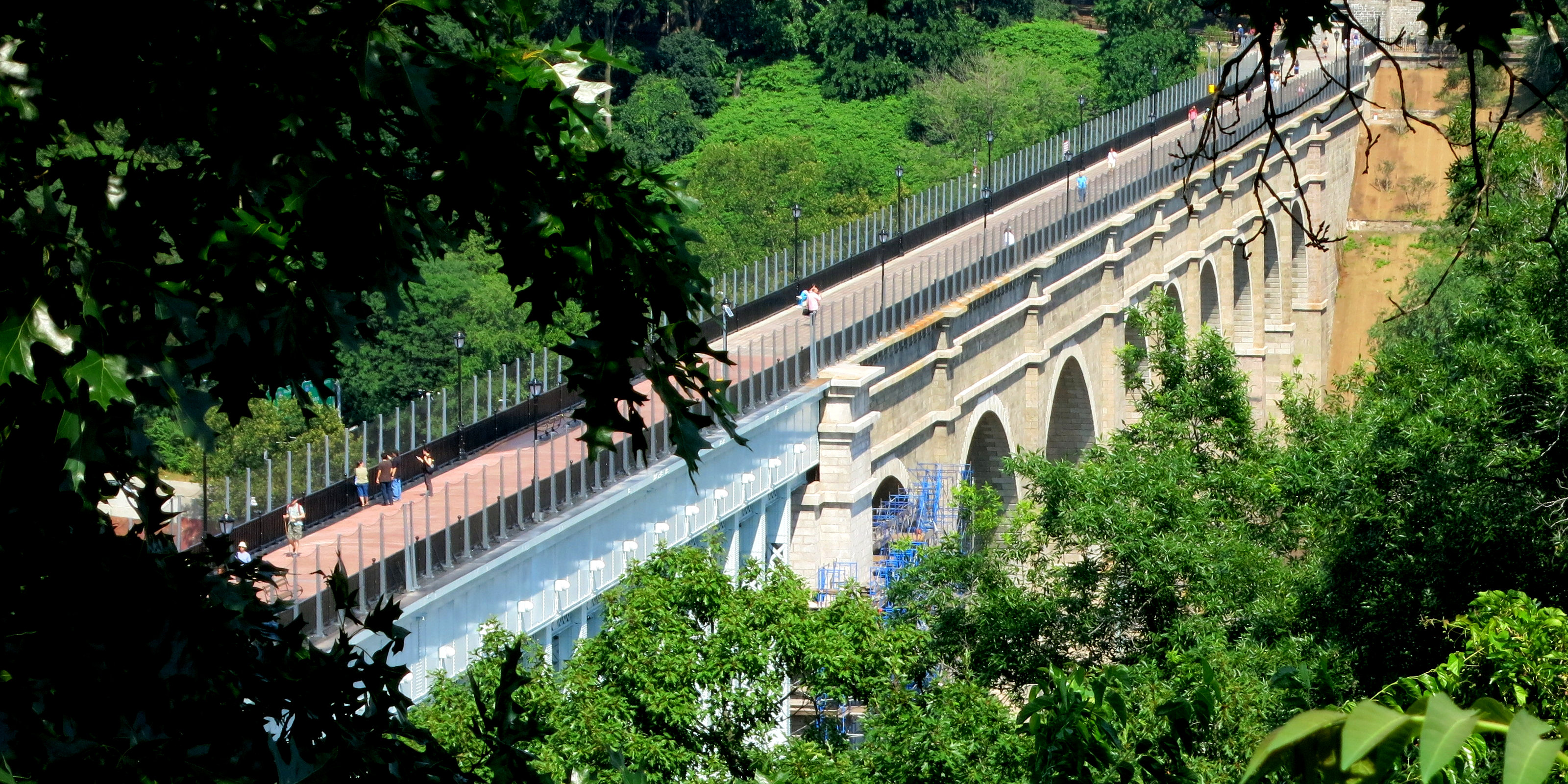
Our destination: the newly reopened High Bridge seen from above, near the tower
You should also remember that following the route of the OCA involves choices of where to go where the original route was changed and in one case, where it went through the city mid-block and is impossible to follow since there is no longer a path along the route to walk on. So I've laid out a route that I would take. I also point out subway stations near the route at various points, so you can decide where to start and how far you want to go. 

The last thing to make note of is that the maps I put in below have little red circles at certain points where you can see features or remnants of the OCA. 

Part 1: Fifth Avenue and Central Park — 4 - 6 miles

Fifth Avenue

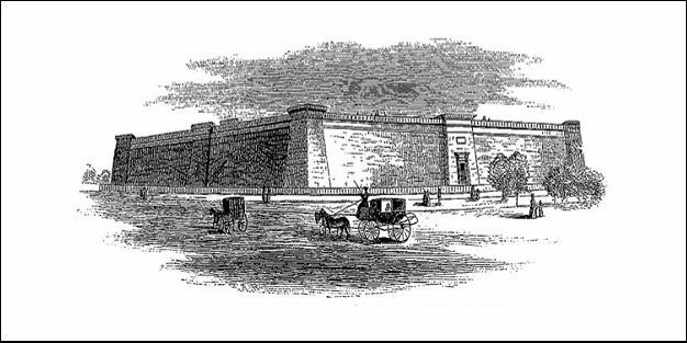
The Murray Hill Reservoir (1842)
The original OCA in 1842 consisted of the Distributing Reservoir (aka the Murray Hill Reservoir) between 40th and 42nd Street, west of Fifth Avenue — it was demolished in 1898-1901 to make way for the NY Public Library —  and a set of iron pipes under Fifth Avenue up to 80th Street which carried the water from the Receiving Reservoir which was in the future Central Park.

We certainly don't need a map for Fifth Avenue, Just go up from the New York Public Library (for out-of-towners, that's on Fifth Avenue between 40th and 42nd Street) to Central Park and enter the park on the path just past the 79th Street Transverse, just before the Metropolitan Museum. Got it? Sound pretty boring, no? Well, let's check out some of the sites along the way, some well known, others not so much. 

The Scene on Fifth Avenue

At first I wanted to highlight any buildings that either pre-dated or were built soon after the OCA was built. Well, there aren't any. Interestingly, the two oldest surviving buildings along Fifth Avenue are St. Patrick's Cathedral (cornerstone laid in 1858) and the Arsenal in Central Park (1847-51), plus, of course, Central Park itself. But the Arsenal is the oldest by far, predating St, Patrick's and Central Park by about a decade.

Central Park followed soon thereafter. Originally authorized in 1853, the plan of the park was approved after a design contest with the "Greensward Plan" by Olmsted and Vaux selected. It was constructed and opened to great fanfare in 1857. The old reservoir had been there for close to 20 years and the new one came along just as the park was being built and was included as an integral part of the plan. Then came the millionaires, and Fifth Avenue would never be the same. 

There's some good pictures in the slideshow below showing of some of the notable structures along Fifth Avenue.

Central Park

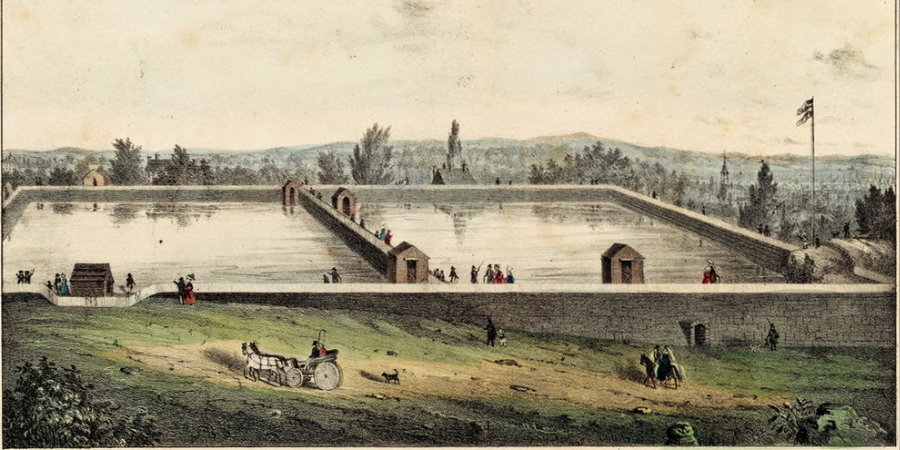
The Yorkville Reservoir (1842)
The original Receiving Reservoir (aka the Yorkville Reservoir) was built between 79th and 86th Streets from Sixth to Seventh Avenue.  It was decommissioned and filled in in the 1930s.  The current Central Park Reservoir was completed in 1862.


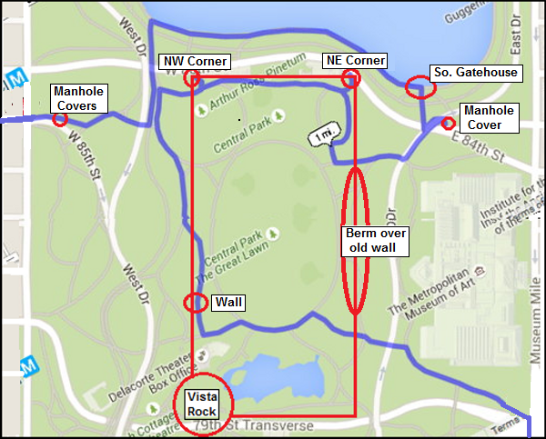
Look at the map to the right — why did I choose that crazy path (the blue line)? Well, you'll see an outline of the old receiving reservoir in red and red circles to note where present day remnants can be found. The suggested route tries to hit them all. 

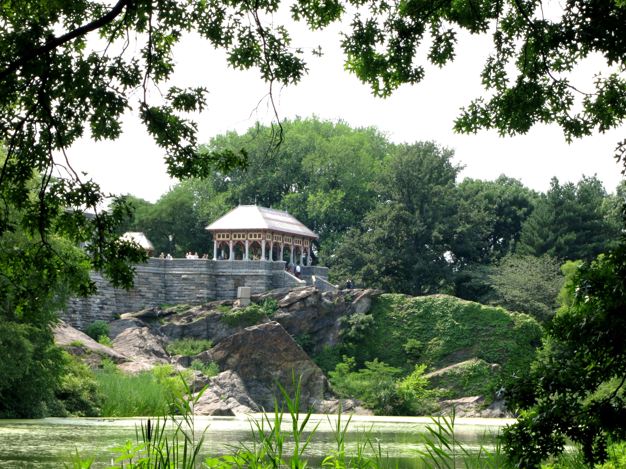
It enters the park on the path between the 79th Street Transverse and the Met, goes through Greywacke Arch under the East Drive and circles around to the west side. When you come out from under the arch make a note of the long north-south berm (mound of earth) that marks the buried east wall of the old reservoir. When the route gets near the Delacorte Theater it heads up roughly along the old mostly buried west wall and touches the NW corner. Before you turn north, look over your shoulder at Vista Rock.  The SW corner of the old reservoir snuggled up against this rock before the castle was built and before the Turtle Pond was even contemplated.

Vista Rock 
Then the route heads back east along the mostly visible north wall (the old brick building are all built up against this wall) to the NE corner. Then it goes up for a stint on the "New Reservoir" (aka the Central Park Reservoir) and goes west along that great lake and finally exits the park at 85th Street. Incidentally, the entry and exit points (80th & Fifth and 85th & Eighth) are both where the original aqueduct passed through the park. And in 1842, the old reservoir was the only above ground feature visible in the park. All the conduits and pipes passing through, were below ground. 

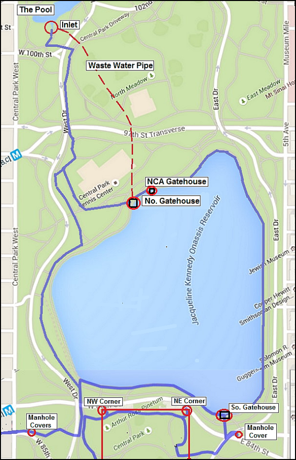
And there's more in the park if you're up for it. You can run completely around the Reservoir and even go up to The Pool at 100th Street on the west side. I've read that this small pond was created, in part, from the overflow of the reservoir — see the item in the remnants section (OCA Page: Features and Remnants).  

So I've added a map (left) for those who want to earn "Extra Credit" in Central Park. Just go right when you get to the South Gatehouse after exploring the Great Lawn, and circle around the reservoir as shown on the map. Now you can say to your friends "You mean you went to see OCA remnants in Central Park and DIDN'T see The Pool Inlet? Dude, that is just soo lame!" Or whatever.

The following slideshow includes the Fifth Avenue and Central Park portions of part 1 of the route. 
  

And now for part 2 of the trek —

Part 2: The upper West Side and Highbridge Park to the High Bridge — just under 5 miles 

Columbus (Ninth) Avenue

Clendening Valley Aqueduct (93rd to 103rd)
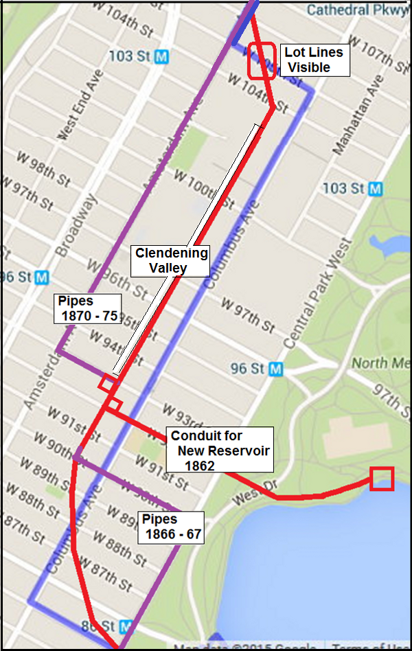
The OCA consisted of a brick conduit from Central Park all the way to 119th & Tenth (Amsterdam).  From about 93rd to 103rd Streets it was above ground between Ninth and Tenth Avenue. The conduit was replaced by under ground pipes in the 1870s. See the map below. 
Once you set foot outside the park you need to know about where the original OCA went. Look at the map to the right. It's not so much a route map for your run as it's a map of the various changes in the OCA over the 2nd half of the 19th Century.

The heavy red line is the route of the original 1842 conduit. In the map the purple lines show where pipes were laid to replace the conduit, first from 85th to 90th, and then from 93rd to 113th where the old conduit crossed the Clendening Valley and headed north up Amsterdam Avenue. And when I say replaced, I mean the old conduit was demolished and buildings were built on the former right-of-way. The only mid-block section to remain was from 90th to 93nd Street, and that too was built over after the OCA was deactivated in 1955. 

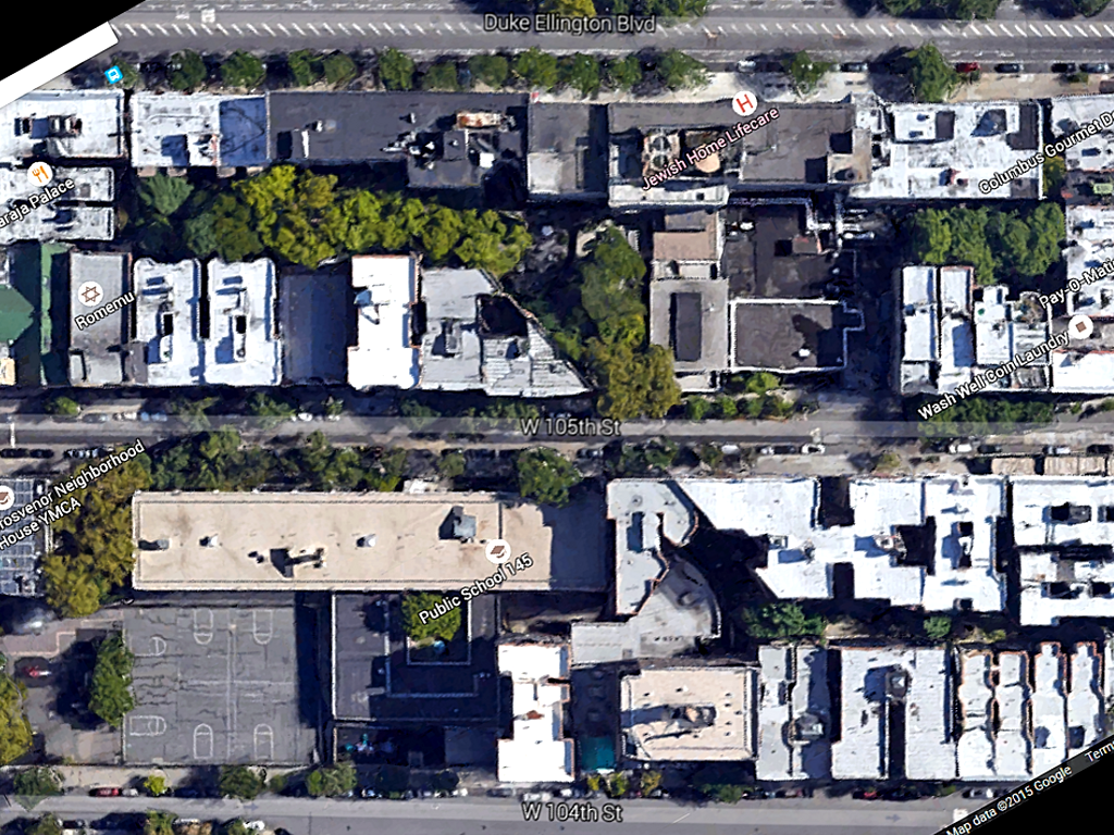
So where should we run? My choice is the blue line. I picked the route mostly to go up on Columbus Avenue since that is closest to the original route, and I cross over to Amsterdam on 105th so you can see the only surviving lot-lines mid block (see Google Earth photo below). It's really cool to see a building suddenly go off an an angle in good old rectilinear New York City.   

The 105th Street lot-lines, from Google Earth


Amsterdam (Tenth) Avenue

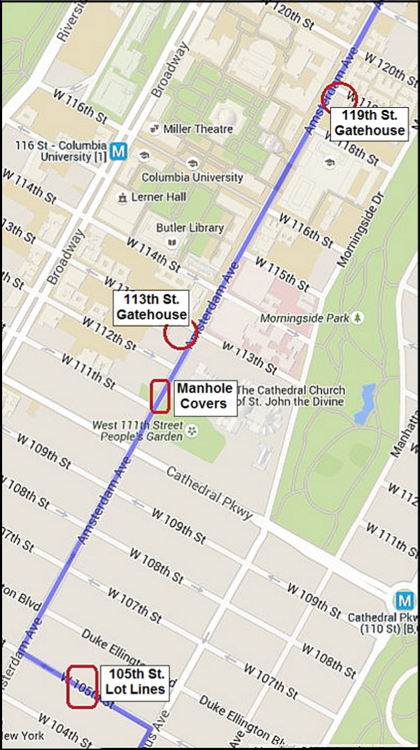
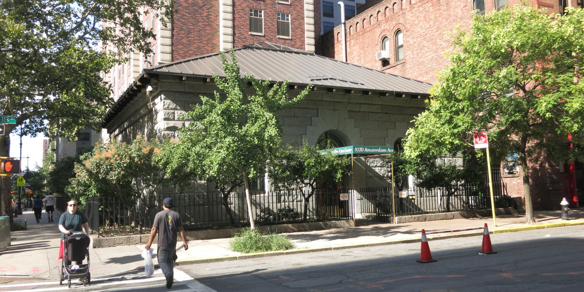
Now direct your attention to the next map on the left. It's really a map of features and remnants (and a few footprints). Starting with the 105th Street lot-lines it goes up to the 113th Street and 119th Street gatehouses with a few manhole covers thrown in between 111th and 112th. BTW: there's a great place for coffee and a sweets at 111th Street opposite the Cathedral. It's the Hungarian Pastry Shop and it's been an Upper West Side institution forever. After that snack break it's just 2 blocks further to the well preserved 113th Street Gatehouse. You'll step over two historic manhole covers in the sidewalk (look down) getting there. 

The 113th Street Gatehouse, now part of a home for the elderly

But before we get to the next gatehouse 6 blocks further on, why not take a break and make a side trip to the Columbia University campus. I did that on a recent scouting trip for this article. Enter at 116th Street and take a glimpse of the main campus with Low Library (formerly a library, now an administration building) on the north end and the Butler Library (an actual library) on the south end as you walk along College Walk. It's a great tonic from the endless low rises, high-rises, churches large and small and endless bodegas and bars along the avenue. And if you have an extra moment, find your way up to the overpass over Amsterdam Avenue between 117th and 118th Streets. Amsterdam Avenue from this vantage point is impressive all the way south to where it crosses the High Line and to the north you can really appreciate the Manhattan Valley and the vast impediment it was to the building of the aqueduct. 

Now back on the avenue, go under that overpass and you'll get to the dilapidated 119th Street Gatehouse. Look at it and weep. 

The OCA was a brick conduit (mostly replaced by pipes in the 1870s) from Central Park up to 119th Street and Amsterdam Avenue, but from there to 135th Street it consisted of underground pipes in what is known as an inverted syphon to cross the Manhattan Valley.  From 135th Street it again consisted of a brick conduit all the way to The High Bridge.

Then when we're through with Columbia comes the Manhattan Valley. Like the Fifth Avenue section, this is a bit boring. It's just 16 blocks along Amsterdam (Tenth) Avenue that goes down and up again. And by no special intent, its goes from Columbia University to City College — although neither one was there when the OCA was originally built. Instead, where Columbia is there was an insane asylum and where City is there was an orphan asylum on one side and a convent on the other (hence "Convent Avenue"). It is a valley, and a fairly deep one (over 100 feet below the line of the aqueduct), and there was some thought of building a huge above-ground aqueduct across the valley, reminiscent of the ancient Roman aqueducts, but that was ruled out due to the expense. So an inverted syphon of pipes it was. Originally it was two 36" pipes, but later a 48" and a 60" pipe were added.  

The Manhattan Valley seen from the Columbia University overpass at 117th Street
At the low point, where Tenth Avenue crossed Manhattan Street (now 125th Street) there was an underground vault (called a "blow-off" vault) where valves could allow the pipes to be drained for maintenance or cleaning. It may still be there under some manhole cover but good luck in finding that in that busy intersection which at the moment is a bit dug up. Maybe I'll go there some day when there's no traffic and sneak a peek down — wanna come? We may find alligators!

Upper Amsterdam Avenue

Congratulations, you've just climbed the only hill worth the name on the whole route and now you are in City College territory. But before checking that out turn right on 135th Street and you'll see the unmistakable gatehouse on the corner of 135th and Convent Avenue. If you think this looks rather different architecturally from any of the other gate houses, including the two you've just passed on Amsterdam and the gatehouses on the Central Park Reservoir, you're absolutely right. It was completed in 1890 for the New Croton Aqueduct (aka the "NCA", naturally) and shows a difference of some 50 years in both technology and sensibilities. 
 
The NCA, as it is called, differs from the OCA in several notable ways, 1) It's supplied by a much larger Croton Reservoir behind the New Croton Dam, 2) it was built entirely underground, and 3) it has a capacity of 3 times the OCA. This gatehouse at 135th Street was the end of the line for the NCA Conduit — about half the output went to the Central Park Reservoir and the rest went directly to the city water mains,


The 135th Street Gatehouse

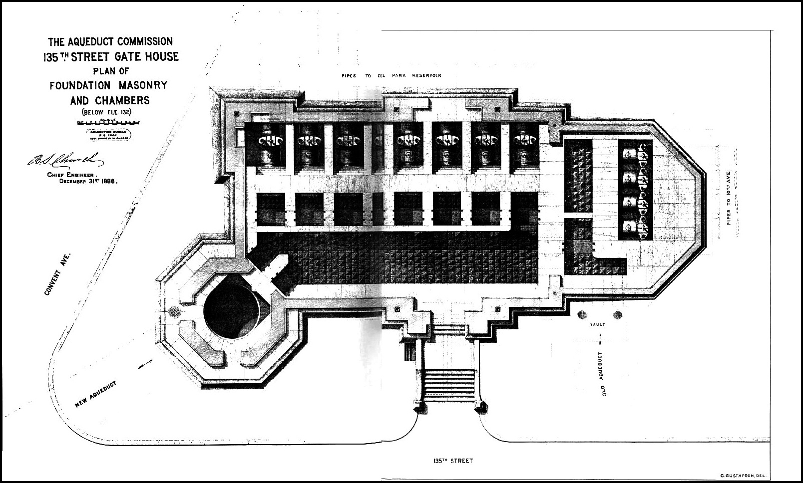
This gatehouse had a peculiar set of needs to fill. First off, the OCA gatehouse at the north end of the Manhattan Valley syphon was sitting a half a block away in the middle of Amsterdam Avenue where it had stood for some 50 years — and it was blocking traffic that would have been unimaginable when it was built. Secondly, the New Croton Aqueduct came down under Convent Avenue from Highbridge Park after passing under the Harlem River and was close to 100 feet underground here, and under pressure. And Third, the NCA would not have a Manhattan Reservoir to hold its entire flow, but rather split it's output between the Central Park Reservoir and the city water mains. 

And as for that faux Egyptian fortress [sic] down on 42nd Street, talk was already in the air of getting rid of it. So this gatehouse had to do everything: control the input flow coming up through a shaft under pressure, control the output flow consisting of no less that eight 48" pipes to various parts of the city, and lastly replace the OCA gatehouse in such a way that flow from either aqueduct could be directed to either. 

The plan for its construction from Wegmann (The Water Supply of the City of New York, 1658-1895 by Eward Wegmann 1896 ) is on the left. Try to see the fine print and you'll get the idea. 

And it did it's job so well that this year, 125 years after its construction, the valves under the gatehouse were used to switch the water from the reactivated NCA into the distribution system of the city. 

Now back to Amsterdam and on with our trek. As you crest the hill you'll see Amsterdam Avenue stretched out before you for about another mile to 155th Street. The old conduit is under the road here but not far under. On your right you'll pass City College with a mixture of beautiful old buildings of dark granite with limestone trim and a nondescript assortment of ugly new buildings. Its worth a look when you pass the main gates at 138th Street and 139th Street. 

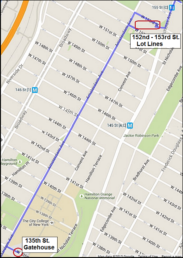
Now keep moving and before you know it you're in the 150s. When you get to 152nd, take a right and on the left side you'll see that characteristic lot-line cut at an odd angle that just screams "AQUEDUCT". The buildings on both sides of this cut go off at about a 45° angle. The cut is now a community garden and it's gated at both ends but on the last two visits I made to this place, first one end, and the other end was open. So I would walk one way and had to turn around and the other time, ditto in the other direction. Maybe you'll be lucky and find both ends open. I call this the "last block of the aqueduct in Manhattan". Some day I'll get through it from end to end. When you go through it, or alas, around it, head up St. Nicholas to 155th (that's Macombs Dam Bridge down the hill — Note: all the 19th century maps and documents spell this "McComb's Dam" ) and cross the street; turn slightly to the left just east of the subway station and walk down along the little triangle of green and you'll be in Highbridge Park.

Highbridge Park and The High Bridge: at last the Real, Original and Genuine Old Croton Aqueduct!

The High Bridge from McComb's Dam (1849 watercolor)
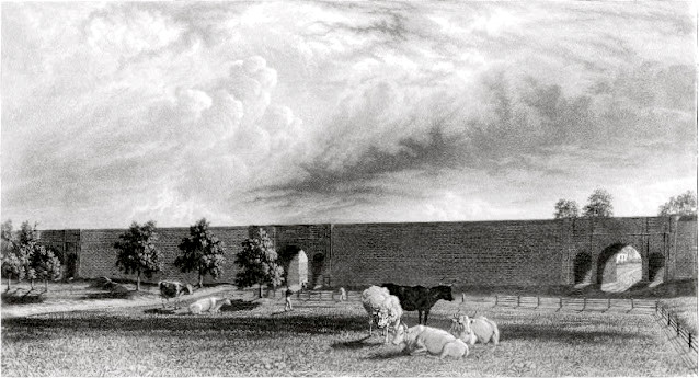
The last section of the OCA we will cover is in Highbridge Park.  It's the original aqueduct with rock retaining walls and deep rock cuts along the side of the steep cliffs in this park. The High Bridge took 6 more years to finish.  The watercolor on the left dates from 1849, within a year of the bridge's completion.

The OCA crosses 155th Street diagonally and heads down along the west side of the triangle of green west of Edgecombe Ave. Cross over and you'll be on the sidewalk next to Highbridge Park. (Note: the park is spelled "Highbridge Park", the bridge is spelled "The High Bridge"). After crossing a playground and stairs down to the bottom, get on the OCA opposite 158th Street. It's about a mile to High Bridge and the first half is on dirt. 

The OCA at a rock cut in Highbridge Park
And when you see the rock cuts the aqueduct went through, remember the workers had only pick and shovel and dynamite to work with. Those cuts plus the steep cliffs both above and below the route can only make you marvel. And whether this is the first or last segment you've seen, there is NOTHING else this rugged in the entire 41 miles of the OCA.

After a little detour around a rocky knoll, you'll get on a paved portion which also serves as a bike path. You'll know it when you get to the bridge since there will be lots of folks looking around checking out the newly reopened bridge. 

Glad you made it all the way.  Join me again for the next run – Papa Bear

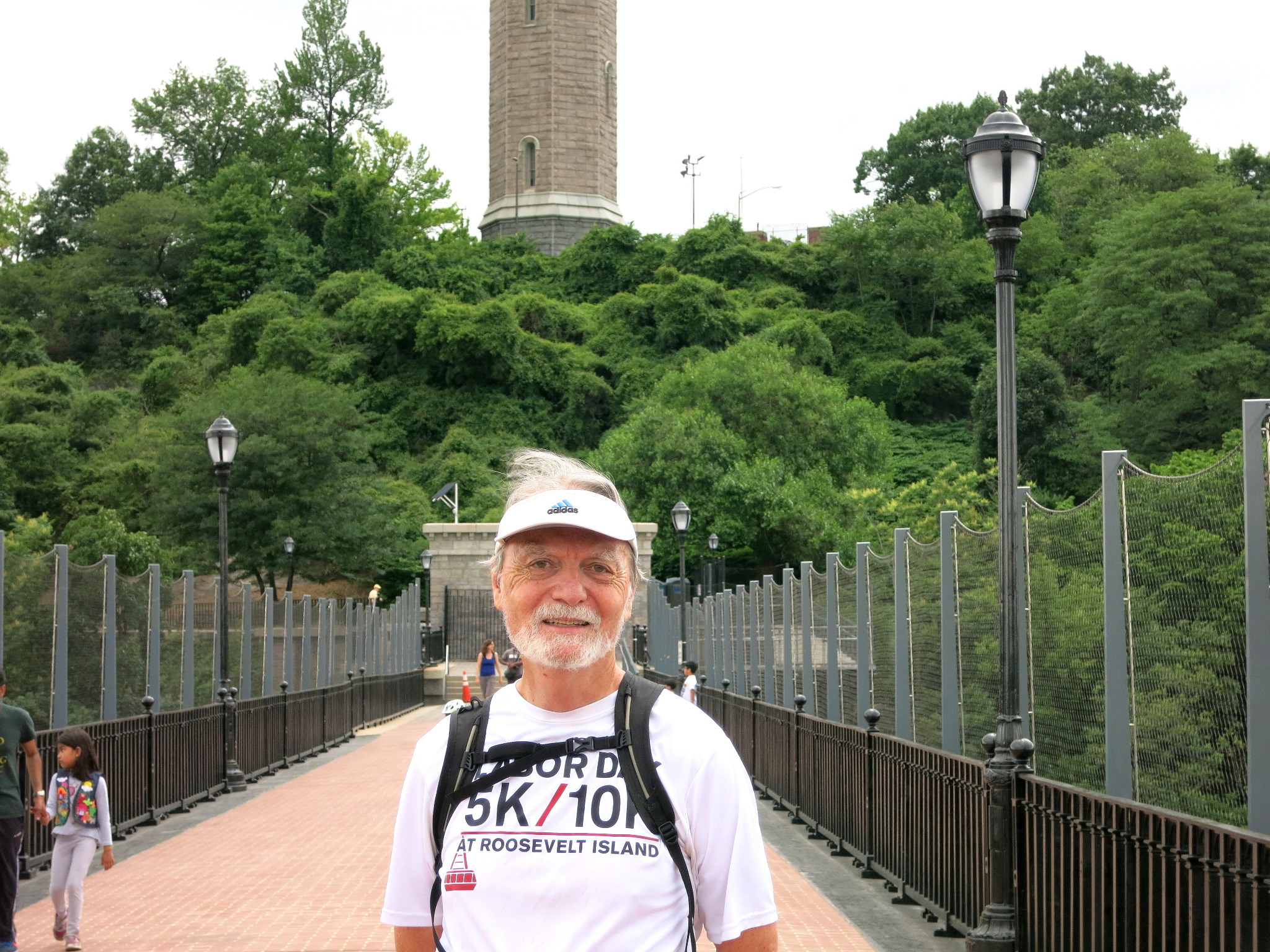
Even if you're not going on through the Bronx, go over the bridge and back anyway and enjoy the view. You've never seen the Harlem River from this vantage point. Take a look back at the High Bridge Water Tower which used to supply water to this portion of Manhattan. 


I put together a slideshow as part of a post about the bridge, its history, restoration and reopening this June on the main OCA page (here: Slideshow: The History, Restoration and Reopening of The High Bridge). The slideshow is especially informative on the bridge and its history.

If this is your end point, go up the stairs and find your way over to the A train at 168th Street and Broadway and if you're going on, good luck for a longer run. Go dté tú slán!

As always,
Papa Bear


Read more...

  © Blogger templates The Professional Template by Ourblogtemplates.com 2008

Back to TOP