
A Run along the Old Croton Aquduct in Manhattan
by Papa Bear
 |
| The New York Public Library (site of the original Distributing Reservoir) - our starting point |
Since those early treks I have run and walked many miles on the OCA, particularly in Highbridge Park and in various parts of the Bronx, Yonkers, Hastings-on-Hudson, Dobbs Ferry, Irvington and Tarrytown.
Finally, with the long awaited reopening of the High Bridge just this April (2015) I decided to put together one large post on my web site describing the OCA in general — its history, changes, remnants, etc. — plus this report on a trek over the Manhattan miles. Think of this as the completion of that 1970 trek that was stopped at the bridge.
Many of you have run along the OCA, most likely in Van Cortland Park or perhaps Highbridge Park. If you have, you know the path is pretty flat and easy to follow. Manhattan is different. Except in Highbridge Park, the original path has completely disappeared from view. The parts that were above ground, were demolished and instead the water flowed through pipes below ground.
And in spite of the demolitions and relocations in Manhattan, the OCA stayed in use through two World Wars, the Great Depression, and the building of three additional aqueducts till it was finally decommissioned in 1955.
But before you start your Manhattan trek I highly recommend you read the general OCA post on my web site which will give lots of background for this post including a description of all the remaining features and remnants of the aqueduct. Here's the Link .
This route starts at the NY Public Library and goes all the way to the High Bridge. And if you want to cross over the High Bridge and head up through the Bronx and beyond, more power to you. I've divided the route into two approximately equal sections for those who prefer smaller pieces to chew on.
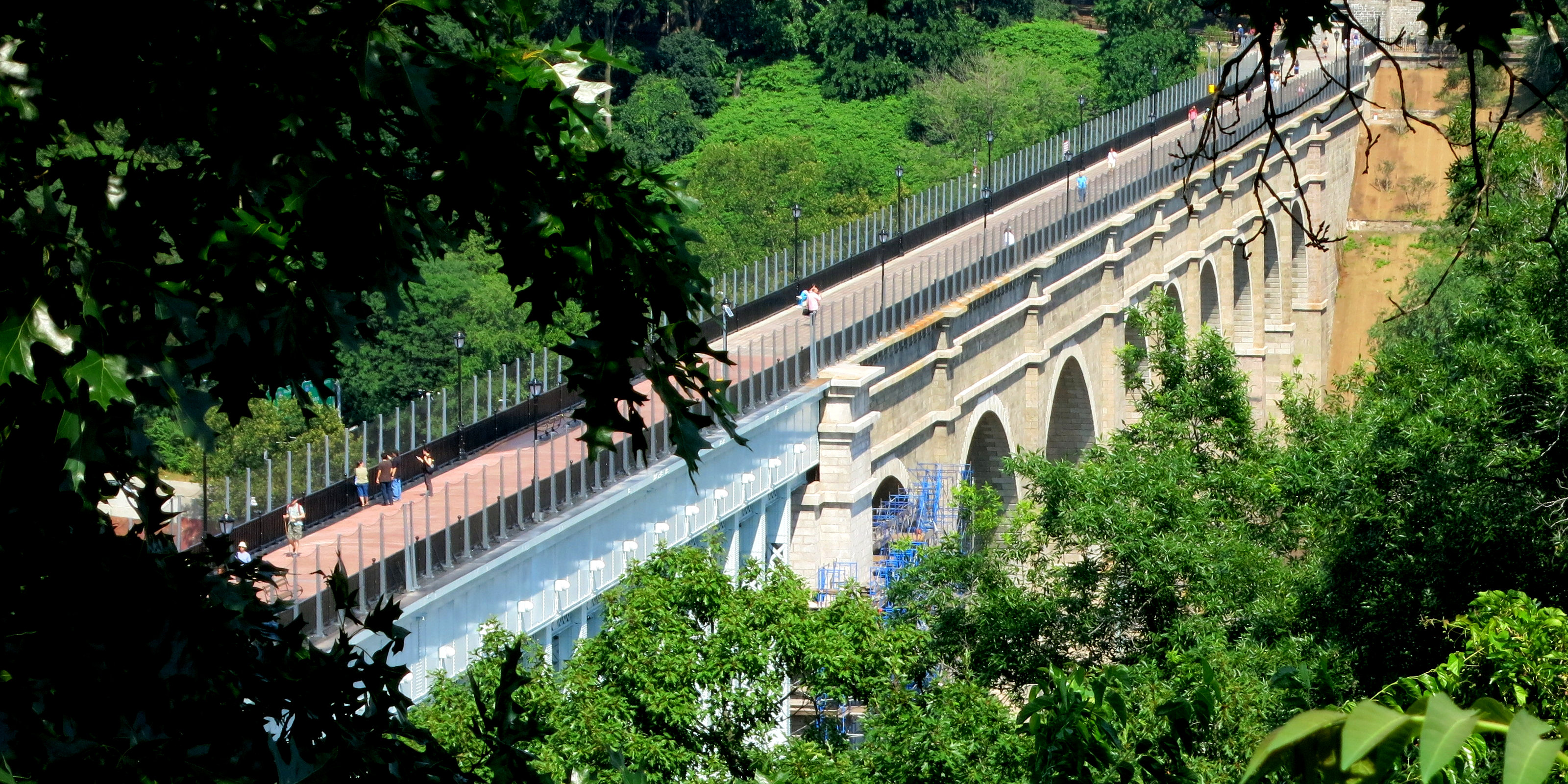 |
| Our destination: the newly reopened High Bridge seen from above, near the tower |
The last thing to make note of is that the maps I put in below have little red circles at certain points where you can see features or remnants of the OCA.
Part 1: Fifth Avenue and Central Park — 4 - 6 miles
Fifth Avenue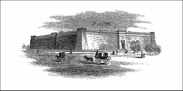 |
| The Murray Hill Reservoir (1842) |
We certainly don't need a map for Fifth Avenue, Just go up from the New York Public Library (for out-of-towners, that's on Fifth Avenue between 40th and 42nd Street) to Central Park and enter the park on the path just past the 79th Street Transverse, just before the Metropolitan Museum. Got it? Sound pretty boring, no? Well, let's check out some of the sites along the way, some well known, others not so much.
 |
| The Scene on Fifth Avenue |
At first I wanted to highlight any buildings that either pre-dated or were built soon after the OCA was built. Well, there aren't any. Interestingly, the two oldest surviving buildings along Fifth Avenue are St. Patrick's Cathedral (cornerstone laid in 1858) and the Arsenal in Central Park (1847-51), plus, of course, Central Park itself. But the Arsenal is the oldest by far, predating St, Patrick's and Central Park by about a decade.
Central Park followed soon thereafter. Originally authorized in 1853, the plan of the park was approved after a design contest with the "Greensward Plan" by Olmsted and Vaux selected. It was constructed and opened to great fanfare in 1857. The old reservoir had been there for close to 20 years and the new one came along just as the park was being built and was included as an integral part of the plan. Then came the millionaires, and Fifth Avenue would never be the same.
There's some good pictures in the slideshow below showing of some of the notable structures along Fifth Avenue.
Central Park
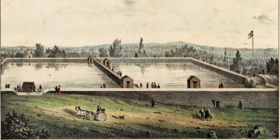 |
| The Yorkville Reservoir (1842) |
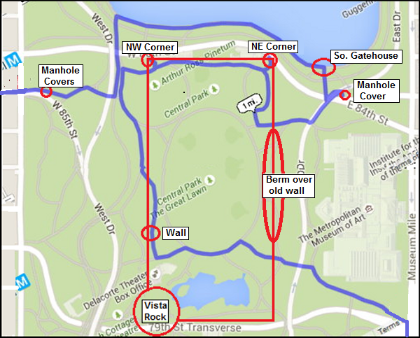
It enters the park on the path between the 79th Street Transverse and the Met, goes through Greywacke Arch under the East Drive and circles around to the west side. When you come out from under the arch make a note of the long north-south berm (mound of earth) that marks the buried east wall of the old reservoir. When the route gets near the Delacorte Theater it heads up roughly along the old mostly buried west wall and touches the NW corner. Before you turn north, look over your shoulder at Vista Rock. The SW corner of the old reservoir snuggled up against this rock before the castle was built and before the Turtle Pond was even contemplated.
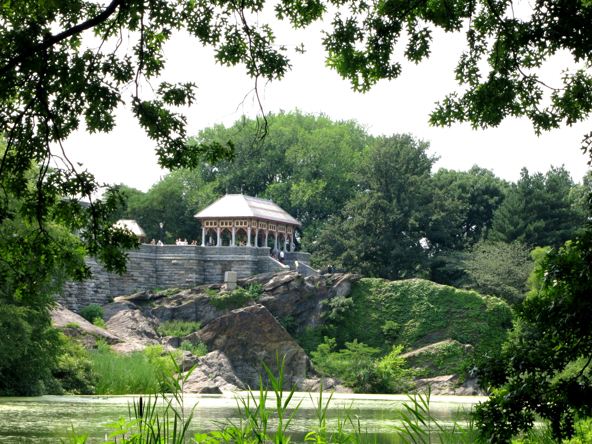 |
| Vista Rock
Then the route heads back east along the mostly visible north wall (the old brick building are all built up against this wall) to
the NE corner. Then it goes up for a stint on the "New Reservoir"
(aka the Central Park Reservoir) and goes west along that great lake
and finally exits the park at 85th Street. Incidentally, the entry and exit points (80th & Fifth and 85th & Eighth) are both where the original
aqueduct passed through the park. And in 1842, the old reservoir was the
only above ground
feature visible in the park. All the conduits and pipes passing
through, were below ground.
|
And there's more in the park if you're up for it. You can run completely around the Reservoir and even go up to The Pool at 100th Street on the west side. I've read that this small pond was created, in part, from the overflow of the reservoir — see the item in the remnants section ().
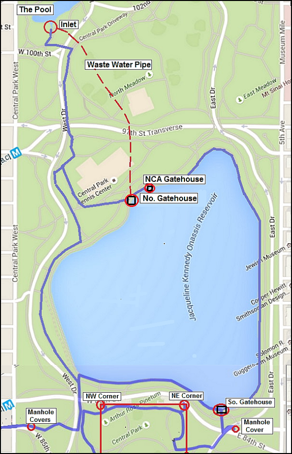
The following slideshow includes the Fifth Avenue and Central Park portions of part 1 of the route.
And now for part 2 of the trek —
Part 2: The upper West Side and Highbridge Park to the High Bridge — just under 5 miles
Columbus (Ninth) Avenue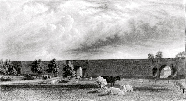 |
| Clendening Valley Aqueduct (93rd to 103rd) |
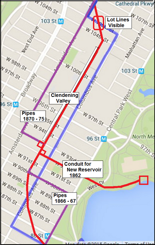
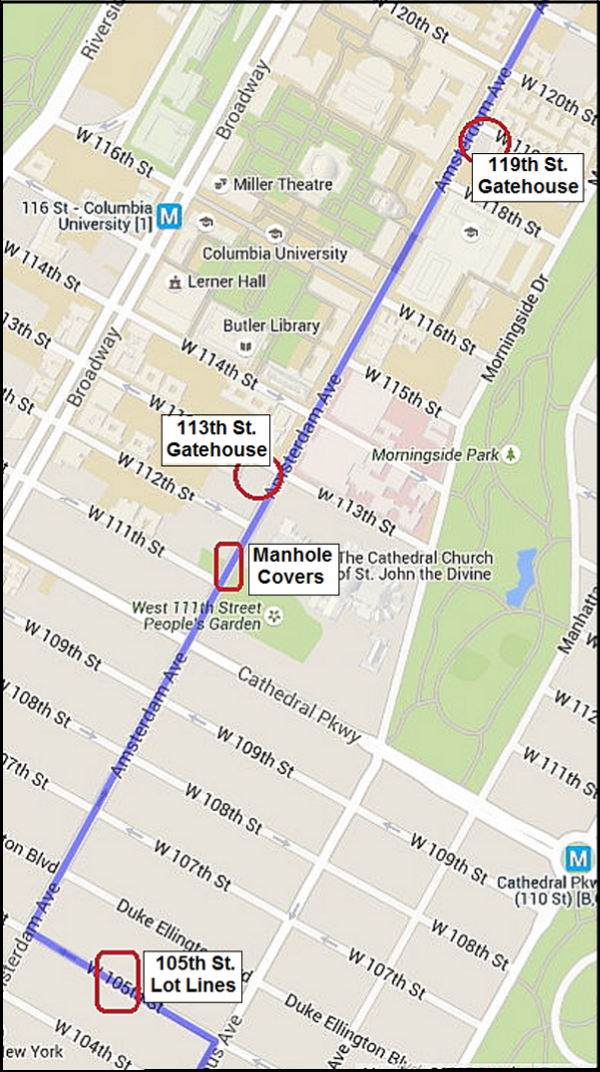
The heavy red line is the route of the original 1842 conduit. In the map the purple lines show where pipes were laid to replace the conduit, first from 85th to 90th, and then from 93rd to 113th where the old conduit crossed the Clendening Valley and headed north up Amsterdam Avenue. And when I say replaced, I mean the old conduit was demolished and buildings were built on the former right-of-way. The only mid-block section to remain was from 90th to 93nd Street, and that too was built over after the OCA was deactivated in 1955.
So where should we run? My choice is the blue line. I picked the route mostly to go up on Columbus Avenue since that is closest to the original route, and I cross over to Amsterdam on 105th so you can see the only surviving lot-lines mid block (see Google Earth photo below). It's really cool to see a building suddenly go off an an angle in good old rectilinear New York City.
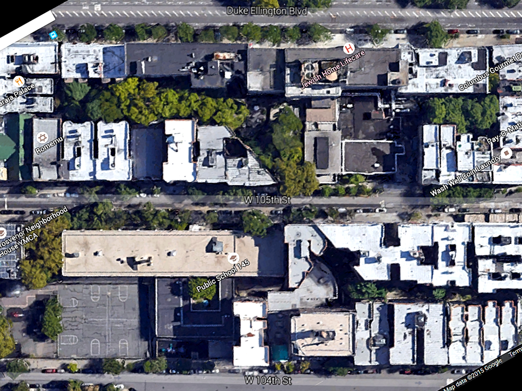 |
| The 105th Street lot-lines, from Google Earth |
Amsterdam (Tenth) Avenue
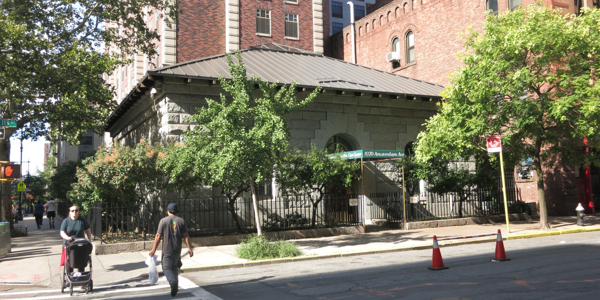 |
| The 113th Street Gatehouse, now part of a home for the elderly |
But before we get to the next gatehouse 6 blocks further on, why not take a break and make a side trip to the Columbia University campus. I did that on a recent scouting trip for this article. Enter at 116th Street and take a glimpse of the main campus with Low Library (formerly a library, now an administration building) on the north end and the Butler Library (an actual library) on the south end as you walk along College Walk. It's a great tonic from the endless low rises, high-rises, churches large and small and endless bodegas and bars along the avenue. And if you have an extra moment, find your way up to the overpass over Amsterdam Avenue between 117th and 118th Streets. Amsterdam Avenue from this vantage point is impressive all the way south to where it crosses the High Line and to the north you can really appreciate the Manhattan Valley and the vast impediment it was to the building of the aqueduct.
Now back on the avenue, go under that overpass and you'll get to the dilapidated 119th Street Gatehouse. Look at it and weep.
The OCA was a brick conduit (mostly replaced by pipes in the 1870s) from Central Park
up to 119th Street and Amsterdam Avenue, but from there to 135th Street
it consisted of underground pipes in what is known as an inverted syphon
to cross the Manhattan Valley. From 135th Street it again consisted of a
brick conduit all the way to The High Bridge.
Then when we're through with Columbia comes the Manhattan Valley. Like the Fifth Avenue section, this is a bit boring. It's just 16 blocks along Amsterdam (Tenth) Avenue that goes down and up again. And by no special intent, its goes from Columbia University to City College — although neither one was there when the OCA was originally built. Instead, where Columbia is there was an insane asylum and where City is there was an orphan asylum on one side and a convent on the other (hence "Convent Avenue"). It is a valley, and a fairly deep one (over 100 feet below the line of the aqueduct), and there was some thought of building a huge above-ground aqueduct across the valley, reminiscent of the ancient Roman aqueducts, but that was ruled out due to the expense. So an inverted syphon of pipes it was. Originally it was two 36" pipes, but later a 48" and a 60" pipe were added.
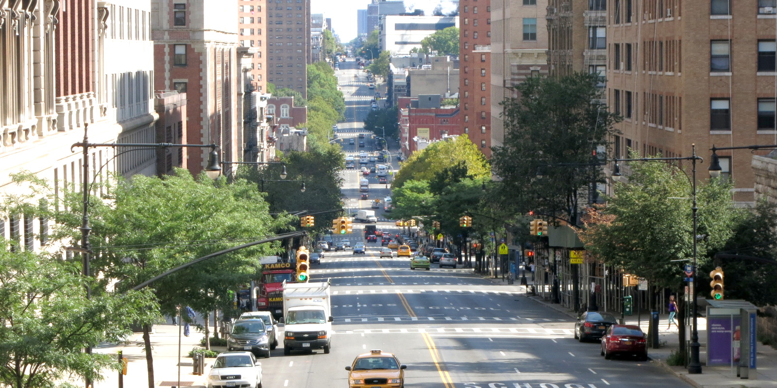 |
| The Manhattan Valley seen from the Columbia University overpass at 117th Street |
Upper Amsterdam Avenue
The NCA, as it is called, differs from the OCA in several notable ways, 1) It's supplied by a much larger Croton Reservoir behind the New Croton Dam, 2) it was built entirely underground, and 3) it has a capacity of 3 times the OCA. This gatehouse at 135th Street was the end of the line for the NCA Conduit — about half the output went to the Central Park Reservoir and the rest went directly to the city water mains,
 |
| The 135th Street Gatehouse |
This gatehouse had a peculiar set of needs to fill. First off, the OCA gatehouse at the north end of the Manhattan Valley syphon was sitting a half a block away in the middle of Amsterdam Avenue where it had stood for some 50 years — and it was blocking traffic that would have been unimaginable when it was built. Secondly, the New Croton Aqueduct came down under Convent Avenue from Highbridge Park after passing under the Harlem River and was close to 100 feet underground here, and under pressure. And Third, the NCA would not have a Manhattan Reservoir to hold its entire flow, but rather split it's output between the Central Park Reservoir and the city water mains.
And as for that faux Egyptian fortress [sic] down on 42nd Street, talk was already in the air of getting rid of it. So this gatehouse had to do everything: control the input flow coming up through a shaft under pressure, control the output flow consisting of no less that eight 48" pipes to various parts of the city, and lastly replace the OCA gatehouse in such a way that flow from either aqueduct could be directed to either.
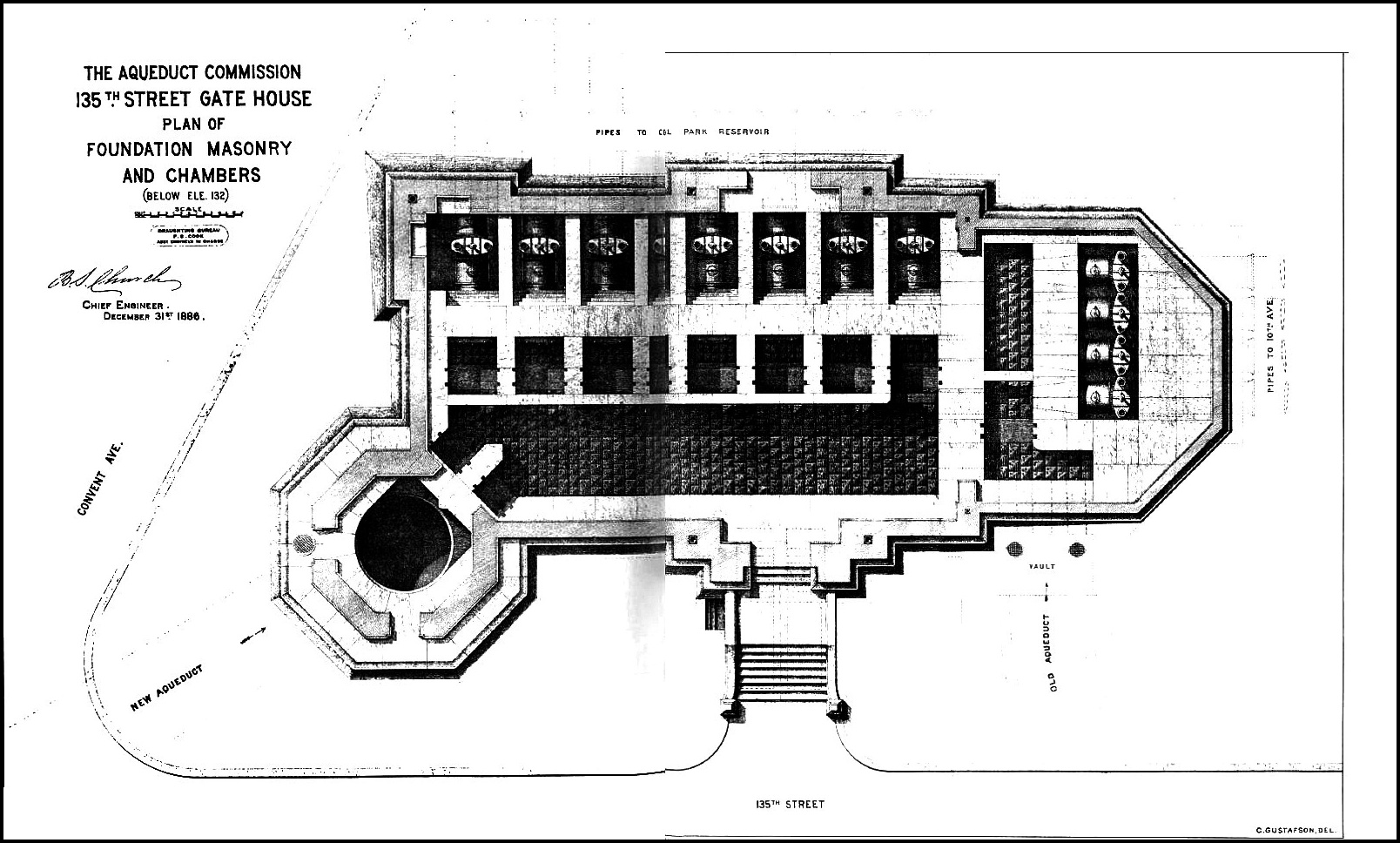
And it did it's job so well that this year, 125 years after its construction, the valves under the gatehouse were used to switch the water from the reactivated NCA into the distribution system of the city.
Now back to Amsterdam and on with our trek. As you crest the hill you'll see Amsterdam Avenue stretched out before you for about another mile to 155th Street. The old conduit is under the road here but not far under. On your right you'll pass with a mixture of beautiful old buildings of dark granite with limestone trim and a nondescript assortment of ugly new buildings. Its worth a look when you pass the main gates at 138th Street and 139th Street.
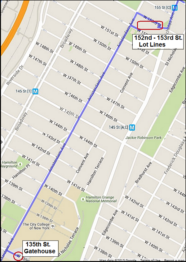
Now keep moving and before you know it you're in the 150s. When you get to 152nd, take a right and on the left side you'll see that characteristic lot-line cut at an odd angle that just screams "AQUEDUCT". The buildings on both sides of this cut go off at about a 45° angle. The cut is now a community garden and it's gated at both ends but on the last two visits I made to this place, first one end, and the other end was open. So I would walk one way and had to turn around and the other time, ditto in the other direction. Maybe you'll be lucky and find both ends open. I call this the "last block of the aqueduct in Manhattan". Some day I'll get through it from end to end. When you go through it, or alas, around it, head up St. Nicholas to 155th (that's Macombs Dam Bridge down the hill — Note: all the 19th century maps and documents spell this "McComb's Dam" ) and cross the street; turn slightly to the left just east of the subway station and walk down along the little triangle of green and you'll be in Highbridge Park.
Highbridge Park and The High Bridge: at last the Real, Original and Genuine Old Croton Aqueduct!
%20Title.jpg) |
| The High Bridge from McComb's Dam (1849 watercolor) |
The OCA crosses 155th Street diagonally and heads down along the west side of the triangle of green west of Edgecombe Ave. Cross over and you'll be on the sidewalk next to Highbridge Park. (Note: the park is spelled "Highbridge Park", the bridge is spelled "The High Bridge"). After crossing a playground and stairs down to the bottom, get on the OCA opposite 158th Street. It's about a mile to High Bridge and the first half is on dirt.
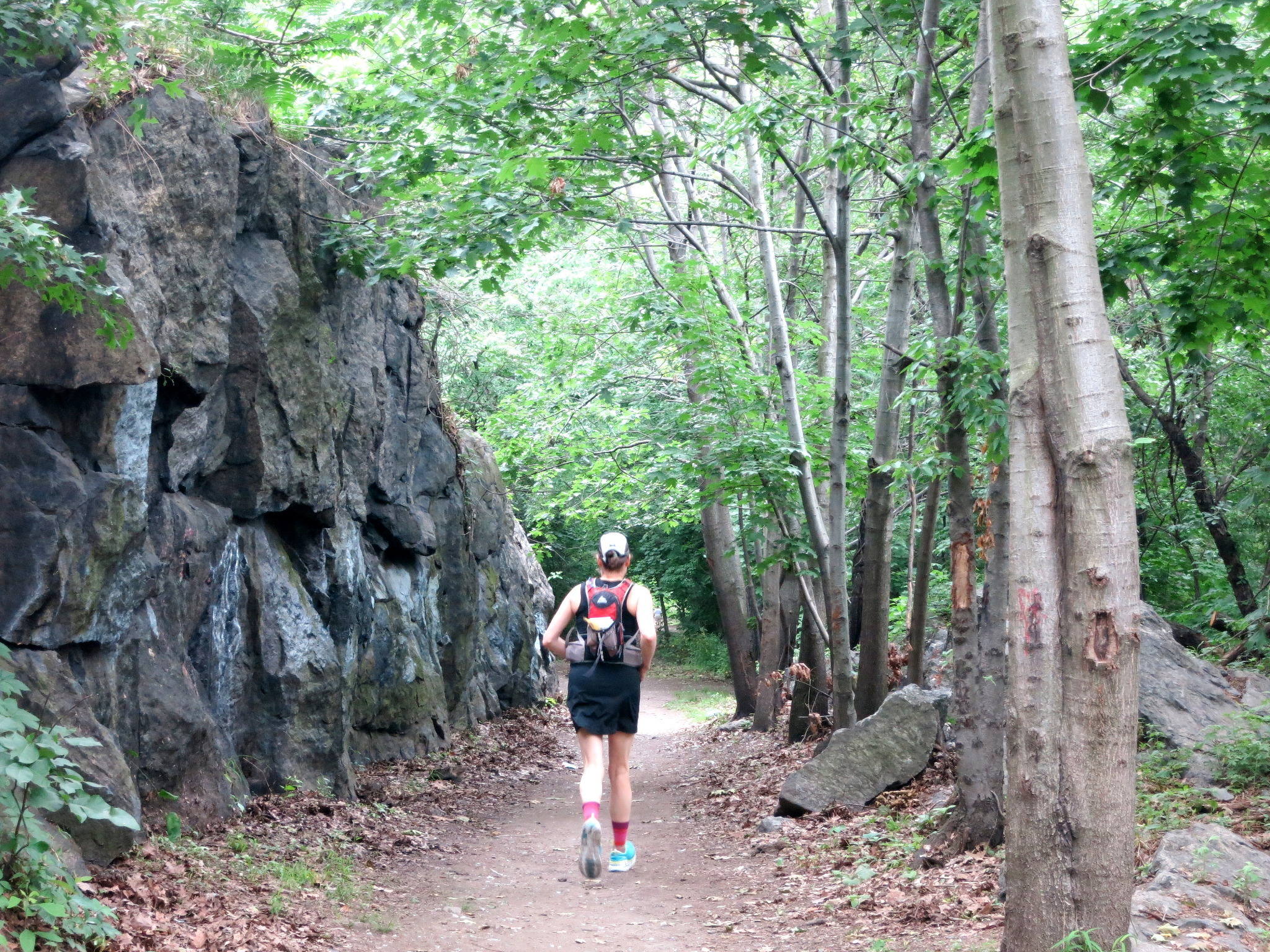 |
| The OCA at a rock cut in Highbridge Park |
After a little detour around a rocky knoll, you'll get on a paved portion which also serves as a bike path. You'll know it when you get to the bridge since there will be lots of folks looking around checking out the newly reopened bridge.
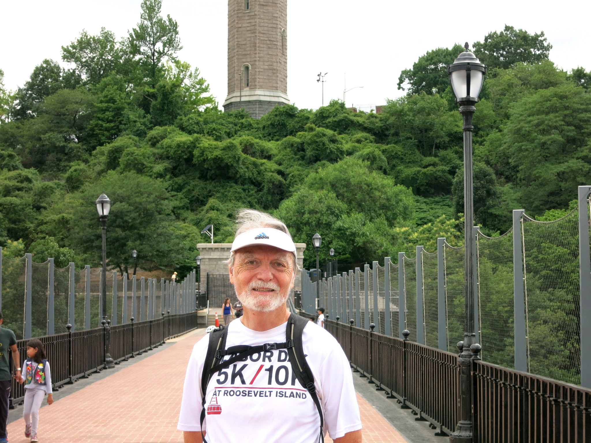 |
| Glad you made it all the way. Join me again for the next run – Papa Bear |
Even if you're not going on through the Bronx, go over the bridge and back anyway and enjoy the view. You've never seen the Harlem River from this vantage point. Take a look back at the High Bridge Water Tower which used to supply water to this portion of Manhattan.
I put together a slideshow as part of a post about the bridge, its history, restoration and reopening this June on the main OCA page (here: ). The slideshow is especially informative on the bridge and its history.
If this is your end point, go up the stairs and find your way over to the A train at 168th Street and Broadway and if you're going on, good luck for a longer run. Go dté tú slán!
As always,
Papa Bear


0 comments:
Post a Comment