
Trail Running 101
 |
| Papa Bear |
by Papa Bear
The ABCs of getting off the roads and onto the trails
A couple of Aprils ago I ran in a 10K trail race in the Bronx. Yes, the Bronx, just at the end of the No. 1 subway line. I had been coming back from some problems in my calves over the winter, so I was pretty far off my pace, but the experience was a tonic for both body and soul. The early spring forest, the weather, the (very modest) crowds and the sheer beauty of the experience — just wonderful!
Interested? Here's a few pointers for making the transition from the crowded roads to the decidedly uncrowded trails.
First, the Whys and Hows
I guess everyone knows the difference between a road and a trail. A road
is something (probably) built for cars, it has a hard surface, but a
uniform one (except for the odd pot hole in New York City), and although
we hate to admit it, the uphill grades are rather mild. Trails were
built (or often just "happened") for foot traffic, they're usually soft —
but watch out for rocks, and the uphill grades can be pretty severe.
But the flip side is you'll develop stronger calf muscles from the effort of taking off from soft ground, stronger ankles and foot muscles and generally much better balance. And that's to say nothing of how much easier it is on your joints without the pounding your knees and ankles get from the roads.
It's somewhat like comparing a good runner with a good basketball or volleyball player. You may be fitter on the roads than you college buddies, but if you join them for a pick-up game in the gym you will be very, very sore that night! Not so, if you're a trail runner.
Now, the simple ABCs for getting started
- A: Use the bridle path
I've been running on the Bridle Path in Central Park as much as I possibly can for probably 25 years. Folks occasionally tell me "Oh, I can't run there — I have weak ankles". Balderdash! The whole point of running there is to strengthen your ankles and your overall balance. And they're so well trodden and flat (except after a downpour) that it would be hard to stumble or trip. (Secret: I have managed to stumble and even hit the ground hard once or twice in my 25 years of Bridle Path running. Don't tell anyone .)
Of course the Bridle Path is hardly what you would call a trail, but it
may be your first step off the roads, and it's right here in Central
Park. Just watch out
for all the horses. BTW: if you live in the outer boroughs, you'll find
bridle paths in Forest Park, Queens, Prospect Park, Brooklyn, and Van
Cortlandt
Park in the Bronx (actually, no bridle paths there, but there's an old
rail trail, and an even older aqueduct that will suffice).
.)
Of course the Bridle Path is hardly what you would call a trail, but it
may be your first step off the roads, and it's right here in Central
Park. Just watch out
for all the horses. BTW: if you live in the outer boroughs, you'll find
bridle paths in Forest Park, Queens, Prospect Park, Brooklyn, and Van
Cortlandt
Park in the Bronx (actually, no bridle paths there, but there's an old
rail trail, and an even older aqueduct that will suffice).
- B: Do cross country races
Some of the best cross country races in the country take place in Van Cortlandt Park, a subway token (or a metrocard swipe) away. High schools and colleges have been taking their teams there since before you were born (even before I was born!). The NYRR has a series of 4 or 5 races every fall, but I think the best races are on warm summer Thursday evenings — the Van Cortlandt Track Club summer 5K series. Why? they are smaller with a more "small town" flavor, and instead of winning medals, you win carrot cakes. And besides, the people running them are really nice. I 've included a description of the series with some background information below as told to me by Fred Daly, the Race director.
- C: Run and race on easy trails
Cross country courses are not trails. They'r really just soft roads that are narrower, curvier, and steeper tha then your average roads. Trails, on the other hand, are trails. Narrow, sometimes rocky, very curvy, and occasionally very steep. I give some routes on local trails below that are good for beginners once you want to move beyond the bridle path and cross country.
And lastly, I describe what I consider to be the best starter trail race around (in the words of Jill Staats, race director). The VCTC Urban Environmental Challenge 10K Trail Race. It's short, it's easy, it's easy to get to, and it's fun.
Just do it!
The Local Scene
The local running club at Van Cortlandt Park puts on the summer cross
country
series, every other Thursday evening in the summer (the "B" of the
ABCs), and the Urban Environmental Challenge (the "C"), a trail race in
April.
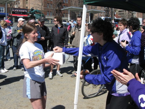 |
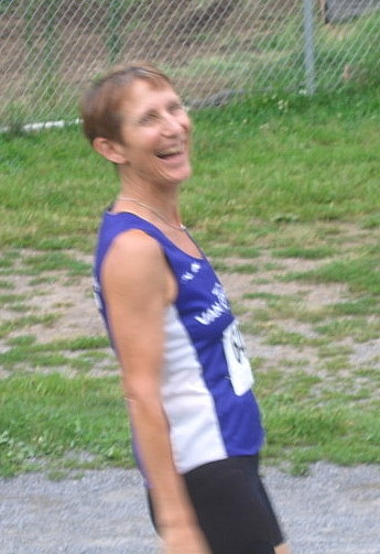
| Susan S. takes home a carrot cake |
I've run all of these over the last 5 or 6 years and I'm not looking back.
A couple of years ago, I asked the race directors of these races (actually, 1 races and a race series) — whom I've gotten to know well — to give us a glimpse of the inside story of putting on these races. The Trail 10 K is coming up on April 13th and the cross country series starts in late May, so get training and some Thursday evening, come on up to the Bronx and enjoy your introduction to cross country — the "B" of the ABCs of trail running. Note: the directors of these races have changed since this report was originally written, but the fun hasn't changed a bit. Enjoy!
The VCTC Summer 5K Cross Country Series
by Fred Daly, Race Director
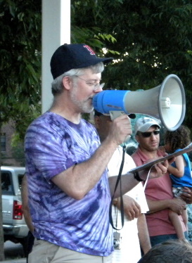 |
| Fred Daly, Race Director |
 |
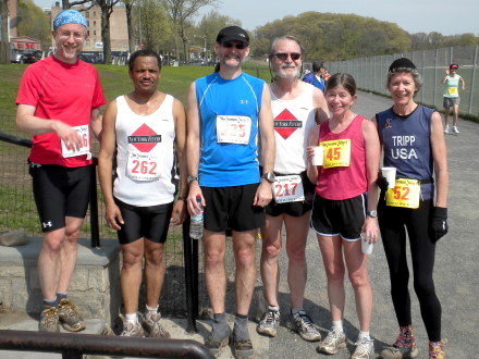
| Some carrot muffin winners among the Flyers |
A couple of times in the past folks in the club have wanted to make a bigger deal of the 5K series, and I've resisted. We don't need or want 400 runners, and we don't need it to be a cash cow for the club. Scoring by
hand is a little stressful, especially on a wet or windy day,
but I prefer it to spending tons of money on an electronic system.
In the first years we'd have maybe 40 runners at the start of the summer
and build to about 80. For a long time, 100 was basically our max. In
recent years it's gotten bigger; the first two this year were about 140,
which makes me a little nervous because it might mean we'll have huge
fields at the end. The most we ever had was about 210. What else is interesting? One of the best features has been the participation of younger runners, especially the Rabbits Club from East Harlem. They missed last year (transportation was not available), but we got them back for the first race this year.
Link for the 5K Cross Country Summer Series (this still has last year's schedule, but I expect they will update it soon): Cross Country Series
The Best Starter Trail Race Around:
The VCTC Urban Environmental Challenge
by Jill Staats
 | ||
| Jill Staats |
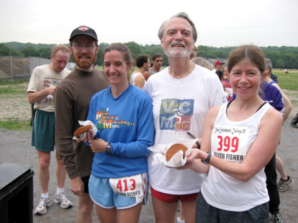
Over the years we have had different sponsors for this race. Last year
it was the clothing company, Eileen Fisher and this year it was
Capital One Bank. We either break even or make a little money on this
race. The “give away” items are usually the biggest cost. Lloyd’s
Carrot Cake has sponsored this race since the beginning. We get 16 small
cakes and 21 muffins as our awards to the age group categories.
 |
| Flyers at the 2010 UEC |
The first year I directed this race, it was the year of the nor’easter. I
came close to canceling it, but because the high winds had died
down, I decided to go on with it. I had 100 pre registered and 20 of
those showed up. There were 40 people that came the day of the race
and registered. I got the most emails that year from people telling me
how much they loved the race. I think people that run this race almost
like the weather to be bad. It was certainly challenging for a newbie
race director. It didn’t stop me; I have done it now for 4 more years.
I have loved doing it and my favorite
part is the day of the race and everyone coming together to make it
happen. That is the great part of being a member of the Van Cortlandt
Track Club.
Some Easy Trail Training Routes:
1) Old Putnam Line and Old Croton Aqueduct Loop
This loop (about 6 miles) goes through some of the parts of Van Cortlandt Park and
Westchester that you will likely never see. Marshes, woods, old
aqueduct structures
built in the 1840s, and the lovely Tibbets Brook Park, not a destination
for the average New York City runner.
The route starts at the south end of VanCortlandt Park on Broadway, a
couple of blocks north of the 242nd Street subway stop.
Link for Riverdale Park: Riverdale Park
Here's a brief description:
The route starts at 225th Street and Broadway on the Bronx side of the Broadway bridge, underneath the 225th Street No. 1 subway stop, aka Marble Hill. You can walk the first part, on streets, but hey! why not run.
Link for Palisades Park: Palisades Park
Link for Palisades Park Maps: Palisades Park Maps
Link for bus along 9W (which stops near points on the Palisades): Route 9W Bus
The slide show depicts a loop I ran with a friend last year. After crossing the GWB, we followed the Long Path (along the top) to just past the road to Greenbrook Sactuary (A wildlife sanctuary run by a non-profit). We then took the Huyler's Landing Trail (marked by red paint blazes) which takes you down to the shore, where you can head back to the GWB either on the road or on the Shore Path. It's about 15 miles total including about 3 miles on the bridge.
Distances given are from the start of the path on the Jersey side and are approximate. Add about 1.5 miles (each way) for the bridge
Papa Bear
A Note on the Slideshows: the slideshows come from Picasa Web Albums (a free service) and don't allow much control for embedded albums. The rep. rate is 3 seconds and the show keeps looping around when you reach the end. You can slow them down using the control at the bottom of the screen and just kill the window when it's looped around (unless you liked it so much you want to watch it again).
 |
| The Old Putnam Line in Van Cortlandt Park |
- Enter the park and head past the old mansion. Bathrooms are available at the nature center.
- Continue across the south end of the field on the track. Enter the woods at the path where the track turns left.
- Go down the path through the woods about 20 yards to the old Putnam Line — a straight dirt path which was formerly a rail line.
- Go north on the path. After about 1.5 miles, you will enter Weschester County where the path is paved and is known as the South County Rail Trail.
- Continue north to Tibbets Brook Park, a paved path to the right just after a bridge.
- Go north on the park road to the bridge over the brook, just before the last lake.
- Circle all the way around the lake (clockwise) and head up the hill to your left, on the path just after the bathroom at the southeast corner of the lake. This climbs several hundred yards to the Old Croton Aqueduct, a level straight dirt path. This is the original aqueduct from Croton to New York City completed in 1848.
- Head south on the aqueduct about 3 miles. The Aqueduct will disappear and you will find yourself on a rough paved path. This will drop down to the right and follow the Mosholu Parkway south, for about 1/4 mile and then head up to the left.
- The rough path will end at the north sidewalk of the Major Deegan. Turn right and cross the overpass where the Deegan crosses over the Mosholu.
- At the west end of the overpass, the sidewalk will disappear and an old stairway will be on the right. The top of the stairway is fenced off. Go around and down to the golf pathway below.
- Circle around to the left (don't go under the Deegan) and follow the golf pathway to the Golf House.
- Cross the road and head straight west on the path through an underpass, and continue along the south end of VanCortlandt Park, arriving back at Broadway at your starting point.
2) Riverdale Park
This a a great little park in the Bronx, and is a largely undiscovered gem. It goes along the Hudson River from a little north of Spuyten Duyvil, up to the Riverdale Train station at 254th Street. It's rolling, but not really hilly, and is very scenic, with views across the Hudson seen through the trees.Link for Riverdale Park: Riverdale Park
 |
| Riverdale Park overlooking the Hudson |
Here's a brief description:
The route starts at 225th Street and Broadway on the Bronx side of the Broadway bridge, underneath the 225th Street No. 1 subway stop, aka Marble Hill. You can walk the first part, on streets, but hey! why not run.
- From the Bronx side of the Broadway Bridge, go left on 225th Street for 1 block.
- Go right on Marble Hill Avenue and stay on it as it bends to the left, and then back to the right.
- Go left on 230th Street and go all the way to Irvin Avenue.
- Go left on Irvin, which becomes Johnson and go up the long hill.
- On the way down the far side of the Johnson Avenue hill, approach the Henry Hudson Bridge far overhead.
- Continue on Johnson, which becomes Palisade Avenue at the bridge.
- Stay on Palisade down and to the right. After about 1/2 mile you will get to 232nd Street with Riverdale Park on the left.
- Enter Riverdale Park at the opening in the fence.
- Stay on the main trail and head north. Eventually you'll get to a street with a few houses.
- Go right up the hill to Palisade Avenue; go left and pass by the houses, then reenter the park at the opening in the fence.
- After about a mile, the trail will come out onto Palisade Avenue and Spaulding Lane will head up to the right. Palisade Avenue will disappear here.
- Get back on the trail and continue through the park to 254th Street, about another half mile.
- From here you can go down the hill to the Riverdale Station and take the train home, or up the hill and right on Independence Avenue to Wave Hill.
- Link to detailed route map: Map (Note: this map shows an expanded route with an extra loop down under the Henry Hudson Bridge and a side trip all the way to the College of Mount Saint Vincent and back.)
2) The Palisades
Palisades Park has a trail anong the top of the cliff, which is actually part of the Long Path, a trail that goes from New York City north to Albany. The Palisades portion goes along the top all the way to the State line, nearly 12 miles. Another trail called the Shore Path follows along the river far below. At intervals along the route, there are trails or roads connecting the top to the bottom, so lots of nice loops are possible. You can run over the GWB or take the bus to Fort Lee. From there you can do an out-and-back, a loop, or do a one way run and take the bus back. The trail is steeper and rockier than the others I've mentioned, but it is absolutely great training for trail racing or running in general.Link for Palisades Park: Palisades Park
Link for Palisades Park Maps: Palisades Park Maps
Link for bus along 9W (which stops near points on the Palisades): Route 9W Bus
The slide show depicts a loop I ran with a friend last year. After crossing the GWB, we followed the Long Path (along the top) to just past the road to Greenbrook Sactuary (A wildlife sanctuary run by a non-profit). We then took the Huyler's Landing Trail (marked by red paint blazes) which takes you down to the shore, where you can head back to the GWB either on the road or on the Shore Path. It's about 15 miles total including about 3 miles on the bridge.
 |
| The Palisades on the Long Path at the cliff top |
Distances given are from the start of the path on the Jersey side and are approximate. Add about 1.5 miles (each way) for the bridge
- Cross the GWB, turn right where the bikers hang out, go under the overpass and enter the park via a pedestrian overpass signed "Long Path".
- Head north through easy woods and meadows passing around Allison Park and St. Peters College after about 1.5 miles.
- Continue north on the left side of the fence at St. Peters College, soon crossing the park road down to the Englewood Boat Basin. Continue with ocasional forays onto the highway verge, to the Rockerfeller Lookout at about 3 miles.
- Continue through more rugged tarrain, crossing the Greenbrook road at about 5 miles
- Turn right on Huyler's Landing Trail (red blazes). Go down to the shore and head south either on the road or the Shore Path at about 6 miles.
- Head south on the road (rolling hills) or path (rough and rocky), arriving at the Englewood Boat Basin (rest rooms, snack bar) at about 10 miles
- Continue south on the shore path, which in this section is wide and flat, to Ross Dock at about 11 miles
- Head south and take the park road about .5 miles to the start on the Carpenter Trail, Do not head up the exit road, stay on the road along the shore.
- Climb the Carpenter Trail (370 stone steps) to the top, bear left and exit the park where you entered.
- Total mileage about 12. Add 3 more for the bridge and back. See this detailed route map: Map. See also the Palisades Park maps linked above.
Papa Bear
This post is adapted from a report on Papa Bear's web site: Beyond Central Park: Trail Running 101 , which in turn was adapted from an article in the April, 2011 NY Flyers Newsletter.
0 comments:
Post a Comment