
Central Park to Kingsbridge 20 Miler

I did this run with two friends in April of 2012. In adapting the report for the Flyers Blog, I've added some descriptive material and occasionally changed the narrative to address the potential runner who may want to give this one a try.
With this post, I have also departed somewhat from describing runs to "beautiful places" and started describing longer runs, since marathon training season is upon us. But rest assured, even if we don't end up at a beautiful place, we will always end up at a great brunch spot.
With this post, I have also departed somewhat from describing runs to "beautiful places" and started describing longer runs, since marathon training season is upon us. But rest assured, even if we don't end up at a beautiful place, we will always end up at a great brunch spot.
| F |
In fact the last time I had been on these two sections was some 40 years ago, when I had hiked the whole aqueduct from Croton to the New York Public Library. So, given I had two willing accomplices, it looked like we had a plan.
Don't know what the Old Croton Aqueduct is? There are lots of web sites out there, you might start with these: Wikipedia, NYC Parks Dept., State Parks Dept., and Friends of the OCA.
Part 1: The Boat House to High Bridge (actually Washington Bridge) — 7 Miles
| T |
he first part of today's run was to get from Central Park to High Bridge Park, where the first part of the OCA in Manhattan is an actual trail (as opposed to lying under Fifth Avenue or Amsterdam Avenue). We've run up there numerous times, so I won't go into the details. Suffice it to say, the beautiful weather and the early Saturday morning hour made these first 7 miles a pleasure. I would also point out that besides running on the aqueduct in High Bridge Park to High Bridge itself (the original crossing of the aqueduct across the Harlem River, now, alas, closed to pedestrians) we continued on to Washington Bridge (no, not the GWB) which affords a route across the river to where we could pick up the OCA in the Bronx.
One slight complication was that the "Scotland 10K" an NYRR sponsored race (= "crowded"), was just going by the Boat House (our starting point) when we got going. To avoid the East Drive and the throngs of runners pouring down it, we detoured slightly up through part of the Ramble, the Great Lawn and around the Reservoir, up over the Dog Track and finally we hit north end of the park. Note to self: it's always a good idea to take a different route once in a while. Don't get stuck in a route-rut.
At this point the report skips to High Bridge Park because that's where we pick up the Old Old Croton Aqueduct. But a little explanation is in order here. There are two ways to get from the north end of Central Park to High Bridge Park: along St. Nicholas Avenue to 155th Street, or through Morningside, St. Nicholas and Jackie Robinson Parks. Both are fairly nice with little traffic on a Saturday morning. I put a nice map in my recent blog post, Runs to Beautiful Places: Fort Tryon Park and The Cloisters and here's the full sized version of that map: Full sized Map. It would help to take a good look at that now especially around 155th Street where everything comes together. These two routes are the "green" one and the "blue" one. The blue line also follows the OCA when it gets to High Bridge Park and ziggs back to Amsterdam at the tower and goes quite near the start of the Washigton Bridge. Here's some detail:
- St. Nicholas Avenue: exit the park at the Sixth Avenue (aka Lenox Avenue) exit and head up St. Nicholas Avenue which starts across 110th Street and heads diagonally up towards the northwest. Pick either side, and head straight up till you hit 155th Street. Then head down the hill to the right and in one block, you'll be at High Bridge Park. That was easy!
- The Parks: exit at the Eighth Avenue (aka Central Park West) exit and go one block west on 110th Street. Cross Manhattan Avenue and enter Morningside Park. Now you will run up through all three parks northward. In Morningside you'll be at the bottom of the rocky cliff, in St. Nicholas you'll be at the top (until the end when you go down some stairs to the bottom), and in Jackie Robinson you'll be at the top on the sidewalk. Look at the map for this route — it's a little more complicated, but it's my preferred route.
When you get to the tower (it's actually quite high above the aqueduct) you'll be at the Manhattan end of High Bridge itself, which was built between 1837 and 1848 to carry the aqueduct over the river. (See This). It was a monumental undertaking. It's being restored to use and I can't wait till the day I write about a run going over it! But for now, you must take the stairs up, go around the tower (which was built as a water tower to supply northern Manhattan) and go north on Amsterdam Avenue to the Washington Bridge (no "George") — and we are finished with the Manhattan section.
Slideshow: Van Cortlandt Park to Yonkers Ave.
(Click Picture for Slideshow) 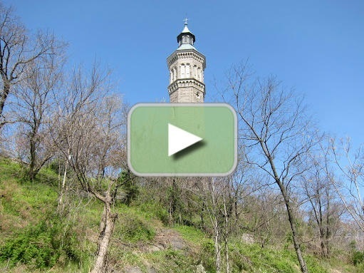 Part 2: Washington Bridge to Van Cortlandt Park — 4 Miles
he Bronx, from High Bridge up to Van Cortlandt Park is the most developed section of the original aqueduct route of all, save for Manhattan itself. But I have found that neighborhoods that were created while the aqueduct was actually in use (up till about the mid 20th century) accommodated the route. They grew up with it, so to speak. In contrast, Manhattan tends to keep rebuilding itself constantly, so old artifacts can be quickly forgotton and obliterated. Additionally, major highways (I-95, The Major Deegan Expressway, etc.) tend to make no accommodation whatsoever and just go barrelling through. I-95 in fact does go barreling through, crossing the Harlem River just north of the old High Bridge. So any hope of finding remnants of the aqueduct in that quarter mile or so north of High Bridge in the Bronx is pretty small. But just above that, the Washington Bridge crossing — which carries street traffic over the river and delivers it to University Avenue — is much more hopeful. Old maps show the route goes from the Bronx side of High Bridge up between Undercliff and University Avenues till it hits a little park just south of I-95. Then it disappears and reappears just north of the mish-mash of highway entrances and exits and follows along (under) University Avenue to West Tremont Avenue, and turns slightly to the right and goes up practically intact to Van Cortlandt Park. So that is where we ran.
After about 4 long blocks on University Ave. we came to West Tremont Avenue, and there ahead, just beyond a side street was a playground with what looked like the aqueduct heading north from the back. The playground was named "Aqueduct Lands Playground" and a map of the aqueduct was actually set into the pavement of the playground! Wow, what a great way to start on the route. But alas, the back of the playground had a locked gate! There was just no getting onto the aqueduct itself. Now why would they build the playground named "Aqueduct Lands" complete with map, and then lock the very thing it's all about?
We could only hope this was temporary and turned back and followed University to the north, with a solid phalanx of buildings blocking us from the pathway. Finally after a bit under a half mile, we got to West Burnside Avenue and all was made right. The locked segment was sitting there to the south of Burnside behind a fence, but to the north a broad stone staircase led up to the aqueduct. The level of the aqueduct was about 15 or 20 feet above the street, so we could only assume there was a viaduct (bridge) here originally. Google concurs (see this and this) and says it was removed sometime in the 1930s and the street was widened. The water was rerouted into what is called an inverted siphon — pipes that go down, under the street, and then back up on the other side. The water pressure pushes the flow down across and up again.
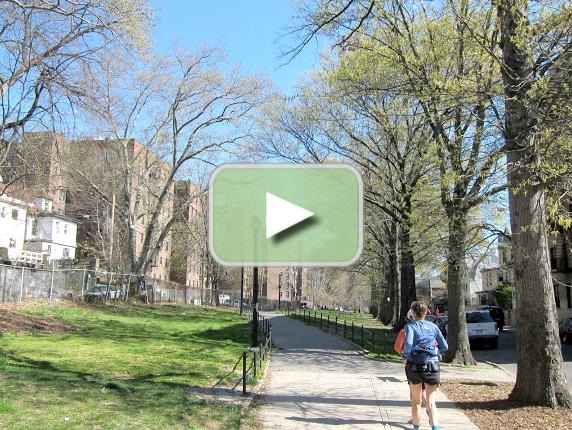
The 4 or 5 segments that followed were delightful. All a little different but all just beautiful with the grass and trees and flowers coming into bloom. And somehow it suited the neighborhood — slightly worn pavement, slightly littered but not trashy. In short it looked "lived in". I can imagine a bit later in the days kids playing hopscotch, and maybe in the evening folks sitting on the benches. Start the slideshow and check out the pictures. You might call it "Bronx Idyllic".
The path ends at Kingsbridge Road with the Kingsbridge Armory across the street. The aqueduct lies under Reservoir Avenue for 2 blocks as we get to the Jerome Park Reservoir. The reservoirs was built in the 1880s for the New Croton Aqueduct. The old aqueduct travels in the space between Goulden Avenue and reservoir. Once we were past the reservoir, Van Cortlandt Park was in site and so ends this part of our run.
Part 3: Van Cortlandt Park to Yonkers Avenue — 3.5 Miles
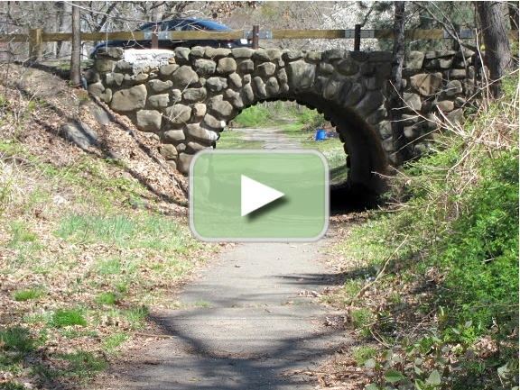
he section of the OCA that goes through Van Cortlandt Park and further up through Tibbetts Brook Park in Yonkers was the one section that is totally familiar to me. I have run this section alone or with friends numerous times, often as a loop with the Putnam Rail Trail which parallels the OCA. But to my great surprise, there were things in the works on this section that I never thought I would see. The Parks Department seems to be fixing things that I have noticed many times which I thought would never be fixed — such as the near washout near the city line, or the exposed section of the aqueduct itself (a brick and stone construction) a bit further south. And they seem to be opening out an inaccessible section east of the Mosholu Parkway and southeast of the Major Deegan Expressway, long lost in brambles and cut off by a golf course. Of course, cynics that we are, we assumed they were just going to pave the whole thing, as they plan to do to the Putnam Rail Trail. But after reading the information carefully, I think that no, they don't intend to pave it — but they do plan to repave some of the access paths to get to it. Read the info on the left and see what you think.
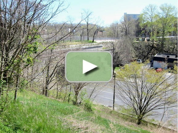
Unfortunately I couldn't find the detailed Parks Department plan on the net, but perhaps it's out there. One thing going for it is that the OCA is a National Historic Landmark, so that may offer some protection. The Friends of the Old Croton Aqueduct, a non-profit advocacy group, does not seem alarmed by the project, so let's hope for the best. If you click on the photo below and watch the slideshow, you will see signs of the on-going work. Ironically, the exposed section (shown in the slideshow), which will be covered over for protection from the elements (and vandals) gives an interesting view of the original construction. It's stone and brick (and I think there's a layer of concrete inside) and it's absolutely amazing that it appears to be in such good shape after 175 years!
As for the run, it was delightful. Ignoring the construction fences and the truck, this section is the only one of the whole aqueduct that passes through undeveloped woodland, and that includes all the route up through Westchester County to Croton. This section alone gives you the feeling of what the area was like in the 1830s.
You'll need a little help getting on to it, primarily because the Major Deegan Expressway cuts through and you have to get around that to get onto the OCA. The original route heads up through the park in a near straight line starting at the east side of the Mosholu Parkway, basically across the street from the park entrance. But that's not a good way to go. Instead follow the paved path along the west side of the Mosholu until you pass under the Major Deegan (about ½ mile).
At this point you have to loop around over a golf cart path and climb up along the side of the embankment of the Deegan. There are stairs here, but they are crumbling. Get to the top of the stairs, go over the fence and turn to the left and follow on the sidewalk as the Deegan crosses over the Mosholu. You have just crossed under the Deegan and over the Mosholu, and you are now where you want to be. At the other side of the overpass, follow a path down the hill and you'll soon be back on the OCA. From here it's a straight shot to Yonkers.
After crossing the city line, we said goodbye to Melissa who headed down through Tibbetts Brook Park (in Yonkers). She was heading back along the Putnam Rail Trail and would meet us for brunch.
Lisa and I ran the rest of the way to the end of Tibbetts Brook Park and got onto the streets briefly to get to Yonkers Avenue. Interestingly, just before leaving the park we passed a gatehouse. These were located at strategic points along the route to allow overflow to be discharged in cases where flood conditions might threaten the aqueduct. And you will notice they are located above streams, which would allow the overflow to be safely discharged. There's another one in Van Cortland Park near the city line. But right after ths Tibbetts' gatehouse there is another building, of rather newer construction. This is a structure that controls the New Croton Aqueduct, which was built in the 1880s to supplement the old one. It's largely underground, so signs of it are seldom noticed. At this point, the New Croton Aqueduct crosses under the Old Croton Aqueduct. Cool!
Part 4: Yonkers Avenue to Kingsbridge — 5.5 Miles
he last section of our run was a big question mark to me. The section through the neighborhoods of the Bronx was much as I had remembered it from 40 years ago with perhaps some improvement in maintenance. The Parks Department has charge of it and except for that closed section, it was in good shape. But the east-west portion through Yonkers was definitely flaky 40 years ago. The route seemed to snake behind run down buildings and was little more than an alley. But the State had just taken over the right-of-way (in 1968) so there was hope.
The first portion, along Yonkers Avenue was never a distinct path. It follows along mostly on the south side of the avenue and of course there is a huge gap where the Saw Mill River Parkway cut through. I remember back then just hiking along across the road cuts and across the overpass and just hoping we'd find something on the other side. I'm glad to say it's better now.
After we passed under the Putnam Rail Trail and along side of the Dunwoody Golf Course we came to the Saw Mill. Well, we knew that was there, but on the other side, at Prescott Street, there was a big granite stone monolith with the letters OCA chiselled on the side. The aqueduct had survived years of neglect!
The aqueduct here resembles the Bronx section somewhat but the pavement is more worn and the litter is definitely trashy. The state had apparently reclaimed the right-of-way, put in some monuments and signage but forgot to pick up the trash. Instead of "Bronx Idyllic" I would call it "Yonkers Shabby."
But one spot stood out 40 years ago and if anything stands out more today, and that's the Nepperhan Viaduct (see this). Originally constructed to cross the Nepperhan River (now the Saw Mill River) it was over 100' high with two culverts for the river and a 20' wide archway for a country road. The road archway was widened to 50' in the 1880s to accommodate a busy Nepperhan Avenue, and again in 1985 a whole new archway was built on the west side of the valley for a much more active Nepperhan Avenue, now a 4 lane divided highway.
I'm sure if the state had not taken it over in 1968 and the U.S. had not named it a National Historic Landmark, they would have just blasted through the old viaduct to widen the road. But the state did, and the U.S. did, so they didn't. And it's just beautiful. If you do this run for no other reason, do it to see this viaduct. My picture doesn't do anything like justice to the structure. My, but I do go on, sorry.
After crossing the viaduct, we crossed north of a ball field and eventually came out to Ashburton Avenue where the path ended. A block later, where North Broadway crosses Ashburton, the aqueduct hangs a right and heads north, once again a dedicated pathway. That we will save for another day, but today we had a 20 miler to complete and a brunch date with Melissa in Kingsbridge, so we ran down the hill another block and turned left (south) on Warburton. We were done with the aqueduct (for today).
The highest point in the Bronx lies a short distance beyond and then it was down hill to Fieldston Avenue. Where Fieldston may be the epitome of Riverdale (which is the epitome of the Bronx), Fieldston Avenue is the epitome of Fieldston, if you get my meaning. If you don't quite follow me, check out some of the "modest" houses in the pictures.
But all good things eventually come to an end and we soon passed out of Fieldston into "ordinary" Riverdale, and thence to Kingsbridge, a place much more my style (and my budget). Around the corner of 238th Street was the An Beal Bocht Cafe where Melissa was waiting for us. It had been a great run with some great discoveries of new places and routes. I can't wait to get back — but first a few days rest. Please.
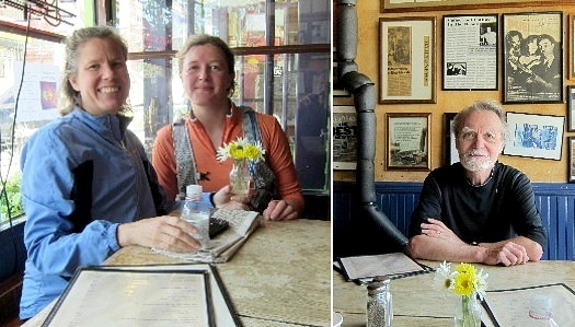
Three Happy Campers Ready for Brunch
This post was adapted and expanded from a report on Papa Bear's web site: Central Park to Kingsbridge 20 Miler
|



0 comments:
Post a Comment